Stephen F. Austin Paddling Trail - Columbia Bottomland Waterway
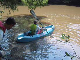
Explore a wooded river escape on this 8.3 mile stretch of the Brazos River through the impressive Columbia Bottomland forests of Texas.
- Getting There
- Trail Description
- Map
- Fishing
- Wildlife & Ecology
- Private Property
- Events & Attractions
- Partnership
Getting There
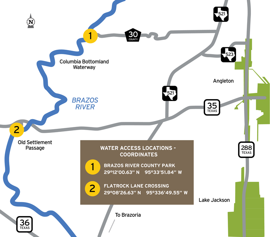
Three access sites:
Put-in: Brazos River County Park
GPS Coordinates (DD): 29.20102, -95.564231
Take-out: Bells Landing
GPS Coordinates (DD): 29.140766, -95.615344
Driving Directions to Access Sites:
Put-in: Brazos River County Park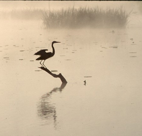 From SH 35, turn north on FM 521 at Bailey’s Prairie, then west on CR 30. Follow to Planters Point Subdivision, enter subdivision and follow roadway to park. From SH 288, turn west on CR 44 near Angleton, south on FM 521 for about 1/4 mile, and west on CR 30. Follow to Planters Point Subdivision, enter subdivision and follow roadway to park.
Access point is near the pavilion, about 400 feet from parking.
Take-out: From SH 35 at East Columbia, turn southeast onto CR 300-F and follow to end of roadway. Access is down the bank.
Distance from nearest major cities:
- Austin - 189
- Corpus Christi - 177
- Dallas - 283
- Galveston - 58
- Houston - 44
- San Antonio - 221
Map
Trail Description and Landmarks
Trail Length: ~8.3 miles
Float Time: ~3-4 hours (depending on water level, flow rate and wind speed)
At low to moderate flow, paddlers will encounter sweeping bends with numerous drift areas and some sandy beaches. Be careful of quicksand along the banks. Although there are no man-made obstructions on this reach, there may be snags to avoid, especially when water levels are low.
This section of the Brazos River is a natural river that is unrestrained by flood control dams or other man made structures. As such, the Brazos River is readily influenced by rainfall runoff that may create high flows and undesirable water quality conditions. Due to the vast length and extensive basin area of the Brazos River, rainfall does not have to be in the immediate area to significantly impact this section of the river. Flow and water quality information is available to paddlers on the web at http://water.weather.gov/ahps/
Landmark - After passing beneath the SH 35 bridge, the take-out access is on the right bank of the river and marked by the old bridge abutment standing out from the bank.
Find information on three additional paddling trails along the Brazos River that are connected to this trail at the following websites: Old Settlement Passage, Sugar Mill Stretch, and Gulf Prairie Run.
Fishing
This section of the river supports numerous freshwater species of catfish, sunfish, and alligator gar; as the river moves toward high tide, the influx of saltwater brings with it redfish, sand trout, flounder, and other saltwater fish. Small lures such as jigs, plastic worms, spinner baits and light-line are generally recommended.
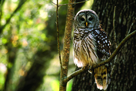
Wildlife and Ecology
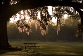
The riparian corridor of the Brazos River supports a great diversity of plant and animal life along the river and beyond the banks. Birds spotted here include many species of migratory birds which vary according to the season. Several varieties of native trees grow along the river, including live oak, ash, pecan, cottonwood, cypress, and elm. Common wildlife encountered include alligators, deer, and small mammals. It is not unusual to see livestock watering in the river.
Private Property
Respect private property by not trespassing or littering and keeping noise levels down. This river and lake are classified as navigable, which permits public use of the streambed and, if necessary, the banks to portage any hazard. Any other use of private river banks without permission of the landowner can be considered trespassing. Under Texas Penal Code (§30.05), criminal trespass occurs when one enters property after receiving notice not to enter. Notice includes verbal notice, a fence, sign(s), purple paint on posts or trees, or the visible presence of crops grown for human consumption.
Events & Attractions
For more information please see the Paddling Events calendar.
 Hudson Woods (Lat. 29.163779; Lon. -95.505309)
On Sally Lake Road off FM 521 north of SH 35. Hardwood bottomland forest and refuge with walking trails. Home of the Brazoria Palm. www.refugefriends.org/history-HWU
Brazoria County Historical Museum (Lat. 29.169025; Lon. -95.431473)
100 E. Cedar, Angleton. Local history exhibits with significant historical artifacts from the county-wide area. Home of the Adriance Research Library. Visitor Center. www.bchm.org
Varner-Hogg State Historic Site
(Lat. 29.163366; Lon. -95.639762)
FM 2852, West Columbia. Early settlement-era plantation site once owned by Gov. James Hogg. www.visitvarnerhoggplantation.com.
Stephen F. Austin Statue (Lat. 29.150465; Lon. -95.450484)
SH 288 south of SH 35. Visit the 67-foot tall statue of the Father of Texas. Park and museum.
Partnership
This trail was made possible through a partnership between Texas Parks and Wildlife Department and Brazoria County Parks Department