Texas Ecosystem Analytical Mapper
TEAM
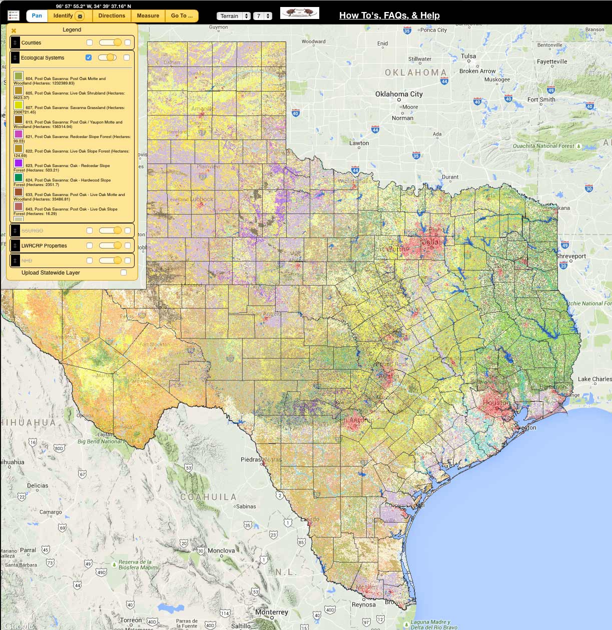
Interactive mapping tool to assist in understanding Texas habitats and to integrate Ecological Mapping Systems Data with land management and resource planning of all types.
- View Ecological Mapping Systems data in relation to soils, hydrology and ecoregion layers
- Print/export custom maps and reports of habitat data for custom areas/boundaries to PDF, KMZ, or Shapefiles
- Calculate acres of vegetation types within an area of interest
*Works best in Google Chrome web browser*
Launch App
Questions or Comments?
Contact Us
TEAM Updates
Information regarding new tools or layers available in the TEAM application can always be found here.
- October 2015 – Buffer Tool is now live! Buffer lines, points, and polygons to create a custom vegetation report.
TEAM Application Support
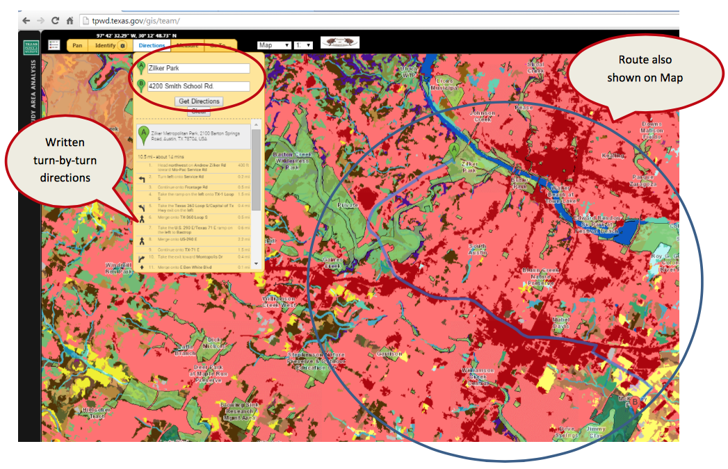
The interactive mapping tool user guide provides visual instructions that describe key functions of the application.
Open User Guide PDF