- The State of the Gulf of Mexico (July 2008)
- The State of Lakes (July 2007)
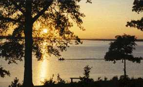
- The State of Wetlands (July 2006)
- The State of Springs (July 2005)
- The State of Rivers (July 2004)
- The State of Bays (July 2003)
- The State of Water (July 2002)

The State of Water in the Prairies and Lakes
Known for its reservoirs and record fishing, this region faces urban sprawl and population growth that is already causing some areas to import water to meet demand.
Major Water Challenge: Maintaining water quality in highly-populated areas.
Water Resource Problems: By 2050, population is expected to double in the metro areas. Water quality and quantity are declining in some areas. Portions of the region are already importing water to meet demand.
Located in north central and central Texas, this region hosts major reservoirs and remnants of the tall grass prairie and wildflowers that greeted early inhabitants. Here you find the rich soil of the Blackland Prairie and the oak "cross timbers" noted by early European explorers. This is where millions of years ago, gigantic dinosaurs roamed and, but a short century ago, Kiowa and Comanche warriors stood against the pioneers. One-hundred-and-fifty years ago, freedom-loving patriots forged the Republic of Texas at Washington-on-the-Brazos, now a state park in this area.
Numerous reservoirs in the region provide water for metropolitan areas while offering unexcelled opportunities for boating and fishing. Eisenhower, Cleburne, Lake Mineral Wells, Cooper Lake, Lake Whitney, Meridian, Ray Roberts Lake and the oldest state park, Mother Neff, are some of the recreational parks in this region, as are Buescher and Bastrop situated in the unique Lost Pines area.
The region can be described as oak savannah, where patches of oak woodland are interspersed with grassland. Introduced grasses such as Bermuda grass are grazed along with forage crops and native grasslands. The landscape of the region is gently rolling to hilly. Elevations range from 300 to 800 feet above sea level.
The Oak Woods and Prairies region is a transitional area for many plants and animals, whose ranges extend northward into the Great Plains or eastward into the forests. This region, sometimes called the Cross-Timbers, was named by early settlers who found belts of post oak, cedar elm, hackberries and hickories crossing strips of prairie grassland.
The Blackland Prairies region is named for the deep, fertile black soils that characterize the area. Blackland Prairie soils once supported a tallgrass prairie dominated by tall-growing grasses such as big bluestem, little bluestem, indiangrass, and switchgrass. Because of the fertile soils, much of the original prairie has been plowed to produce food and forage crops.
Water Supply and Demand
Supply
Major Rivers: Trinity, Red, Brazos
Major Aquifer: Trinity
Use & Demand
- DFW: 92% of the water needs are dependent upon groundwater; 84% demand
is municipal.
Remaining area: 51% of the rest of the region’s water is dependent on groundwater, 49% on surface water. 38% demand is municipal; 33% for irrigation. - Pollutants and agricultural run-off has been detected in waters across the region. Water is already being imported to satisfy growing demands in some areas. (Source: Texas Center for Policy Studies. Texas Environmental Almanac (Austin: U.T. Press, 2002), 21-24.)
Major Cities - Rainfall / Elevation
Regional Average Rainfall: 26-40 in./yr
Regional Av. Net Evaporation rate: 41 inches
Example Cities (Data source: National Climate Datat Center, U.S. Dept of Commerce.)
Albany - 28.45 in / 1,400 ft
Bonham - 44.56 in / 600 ft
Burnet - 32.43 in / 1,275 ft
Comanche -29.41.33 in / 1,358 ft
Dallas - 37.05 in / 440 ft
Gatesville - 33.43 in / 760 ft
Glen Rose - 34.82 in / 656 ft
Gonzales - 36.02 in / 380 ft
Marlin - 37.99 in / 388 ft
Mexia - 40.40 in / 535 ft
Mineola - 45.88 in / 385 ft
Mineral Wells - 31.79 in/ 930 ft
Wills Point - 43.68 in / 522 ft