Table
of Contents:
Proposed Eastex Reservoir
Vegetation Cover Type Changes
| Number of Polygons | 1981 Cover Type* |
1993 Cover Type* |
Acres |
|---|---|---|---|
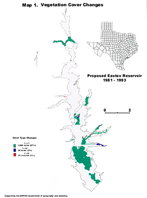
| 12 | 1 | 1 | 1868 |
| 3 | 1 | 4 | 38 |
| 13 | 1 | 5 | 21 |
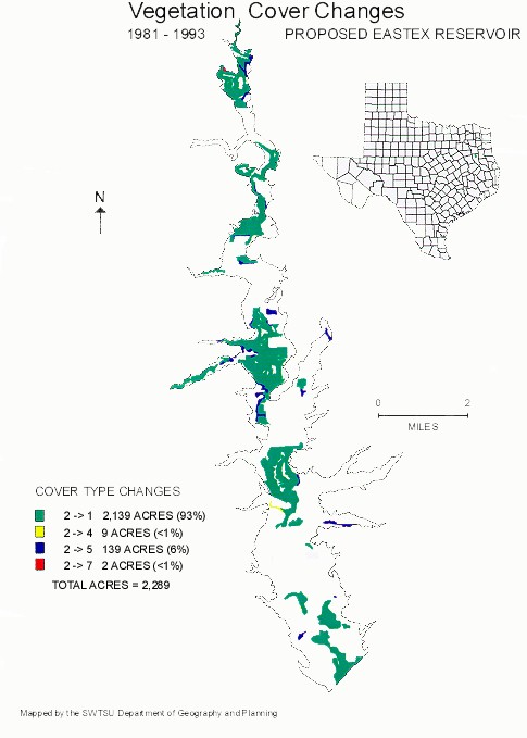
| 24 | 2 | 1 | 2139 |
| 2 | 2 | 4 | 9 |
| 29 | 2 | 5 | 139 |
| 1 | 2 | 7 | 2 |
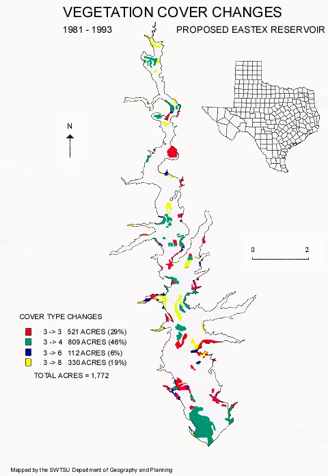
| 41 | 3 | 3 | 521 |
| 37 | 3 | 4 | 809 |
| 48 | 3 | 6 | 112 |
| 31 | 3 | 8 | 330 |
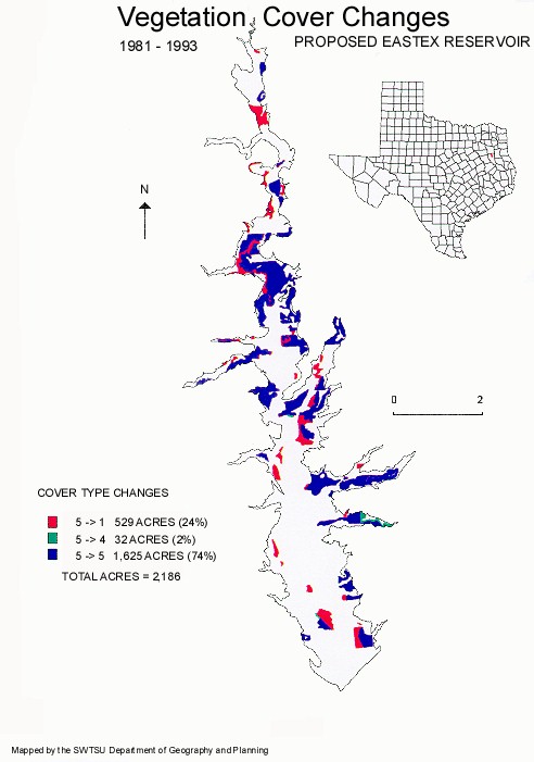
| 44 | 5 | 1 | 529 |
| 4 | 5 | 4 | 32 |
| 46 | 5 | 5 | 1625 |
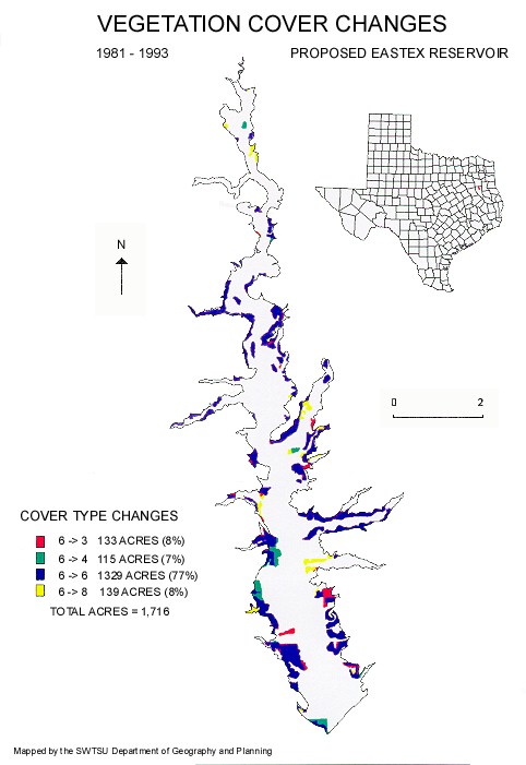
| 35 | 6 | 3 | 133 |
| 14 | 6 | 4 | 115 |
| 82 | 6 | 6 | 1329 |
| 29 | 6 | 8 | 139 |
| 11 | 7 | 7 | 45 |
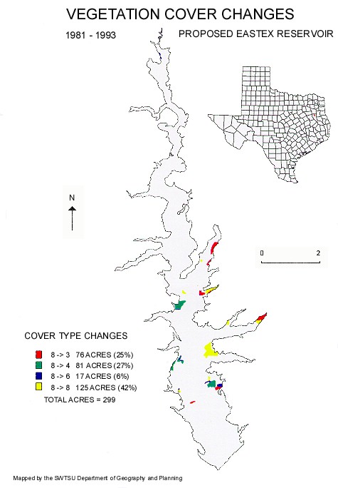
| 7 | 8 | 3 | 76 |
| 4 | 8 | 4 | 81 |
| 12 | 8 | 6 | 17 |
| 9 | 8 | 8 | 125 |
| Totals: 538 | 10234 |
The results of the vegetation cover analysis are summarized in Table 3 and in a series of six maps. Maps are available in both JPG and PDF format. The key to the names of the cover types is shown below. Map legends show the cover type number only.
Map 1 jpg or download  (PDF 185.6 KB)
Map 1 jpg or download (PDF 167.6 KB)
Map 1 jpg or download (PDF 183 KB)
Map 1 jpg or download (PDF 184.8 KB)
Map 1 jpg or download (PDF 185 KB)
Map 1 jpg or download (PDF 159.6 KB)