Ecologically Significant River and Stream Segments
Winter Bayou
Figure 54. Map Location of Winters Bayou
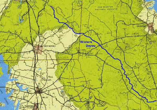
Adapted From The Roads of Texas. Shearer Publishing, 1995.
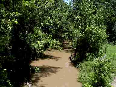
Figure 55. Winters Bayou at State Highway 150
Winters Bayou
Winters Bayou begins east of Huntsville in Walker County and flows southeasterly into San Jacinto County where it empties into the East Fork of the San Jacinto River. The channel is predominantly shallow and narrow with a substrate consisting mostly of sand with intermixed pebbles, silt, and clay. The bayou provides drainage for a major portion of the Sam Houston National Forest despite its low gradient and receives water from numerous spring-fed tributaries such as Pea Creek and Nebletts Creek. The influx of high quality spring water and the presence of abundant woody debris offer a variety of habitats to aquatic life. Minnows, catfish, pirate perch, topminnows, darters, sunfish, and suckers represent fish species collections. Vegetation along the banks is dominated by loblolly pines with interspersed deciduous trees and minimal pastureland. The ecologically significant segment is from the confluence with the East Fork of the San Jacinto River upstream to its headwaters east of Huntsville.
(1) Biological Function- displays significant overall habitat value considering the degree of biodiversity.8
(2) Hydrologic Function- bottomland hardwood forest and associated wetlands perform valuable hydrologic functions relating to flood attenuation and water quality.
(3) Riparian Conservation Areas- fringed by the Sam Houston National Forest.
(4) High Water Quality/Exceptional Aquatic Life/High Aesthetic Value- significant due to high water quality from spring fed resources.8
(Back)