Central Texas Coastal Prairie Riparian
Geology
Beaumont or Lissie Formations.
Landform
Upland drainages accumulating flow from surrounding, mostly level landscape. These drainages are typically erosional, sometimes incised, and rarely accrete significant alluvial deposition.
Soils
Various uplands soils. By definition, this system does not occupy bottomland ecological site types.
Parent Description
This system represents vegetation bordering upland drainages where alluvial deposition is minimal. These sites, however, occupy locally low landscape positions and accumulate moisture from the surrounding landscape. Forested sites typically have a deciduous canopy with species such as Celtis laevigata (sugar hackberry), Ulmus crassifolia (cedar elm), Carya illinoinensis (pecan), Salix nigra (black willow), Prosopis glandulosa (honey mesquite), Acacia farnesiana (huisache), and/or Quercus nigra (water oak). Quercus fusiformis (plateau live oak) may share, or sometimes dominate, the canopy. The shrub layer may be well-developed and include species such Prosopis glandulosa (honey mesquite), Acacia farnesiana (huisache), Diospyros texana (Texas persimmon), Condalia hookeri (brasil), Ziziphus obtusifolia (lotebush), and/or Aloysia gratissima (whitebrush). Some areas may lack a significant overstory and be mapped as shrublands of these species. The herbaceous layer may contain species such Elymus virginicus (Virginia wild-rye), Chasmanthium latifolium (creek oats), Calyptocarpus vialis (straggler daisy), Verbesina virginica (frostweed), and Chloracantha spinosa (spiny aster).
Ecological Mapping Systems
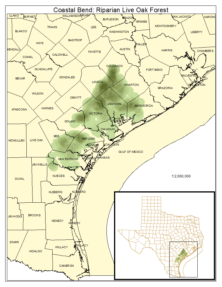
Coastal Bend: Riparian Live Oak Forest
About 12% of this system is composed of this type, where Quercus fusiformis (plateau live oak) or, in some cases Ehretia anacua (anacua), dominates the overstory.
Distribution Map

Public Land Occurrence
Coastal Bend: Riparian Live Oak / Hardwood Forest
Forests or woodlands where canopy dominance is shared by broadleaf evergreen species such as Quercus fusiformis (plateau live oak) or Ehretia anacua (anacua), and deciduous species such as Celtis laevigata (sugar hackberry), Ulmus crassifolia (cedar elm) and others.
Distribution Map

Photos

Public Land Occurrence
- None.
Coastal Bend: Riparian Hardwood Forest
As described for the system, where deciduous canopy species predominate.
Distribution Map

Photos

Public Land Occurrence
Coastal Bend: Riparian Evergreen Shrubland
Upland drainages where shrubs such as Ilex vomitoria (yaupon), Zanthoxylum fagara (colima), Rosa bracteata (Macartney rose), or Acacia farnesiana (huisache) dominate. Celtis laevigata (sugar hackberry), Celtis ehrenbergiana (granjeno), and Prosopis glandulosa (honey mesquite) are often present.
Distribution Map

Public Land Occurrence
- None.
Coastal Bend: Riparian Deciduous Shrubland
Primarily disturbance shrublands of upland drainages dominated by species such as Prosopis glandulosa (honey mesquite), Acacia farnesiana (huisache), small Celtis laevigata (sugar hackberry), Salix nigra (black willow), or Cephalanthus occidentalis (common buttonbush).
Distribution Map

Photos

Public Land Occurrence
Coastal Bend: Riparian Grassland
Sites on upland drainages that often represent managed grasslands dominated by Cynodon dactylon (bermudagrass), Paspalum notatum (bahiagrass), or Bothriochloa ischaemum var. songarica (King Ranch bluestem).
Distribution Map

Public Land Occurrence
- None.
Coastal Bend: Riparian Herbaceous Wetland
Herbaceous dominated wetlands along upland drainages.
Distribution Map
