Ecologically Significant
River and Stream Segments
East Fork San Jacinto River
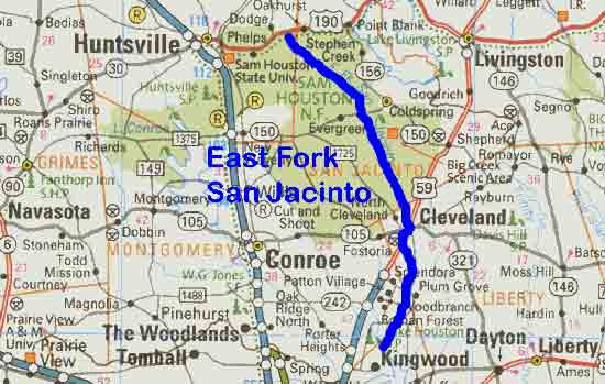
Figure 22. Map Location of East Fork San Jacinto River
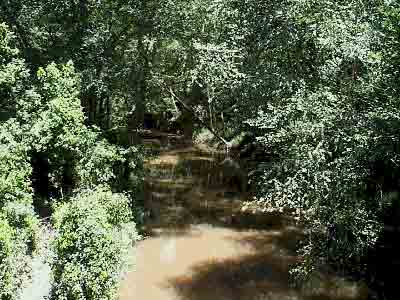
Adapted from Texas Map. Gulf Publishing, 1998.Figure 23. East Fork San Jacinto River south of FM 945
East Fork San Jacinto River
The East Fork of the San Jacinto River originates in San Jacinto County and flows 46 miles through Walker County to Harris County, where it joins Caney Creek and the West Fork to create Lake Houston. The East Fork is narrow and shallow with numerous sandbars and abundant overhanging branches and logjams. The abundant woody debris and sandy substrate provide habitat for a diverse community of macroinvertebrates and fish including minnows, gars, pirate perch, catfish, dusky darters, and several species of sunfish. The dense bottomland forest that surrounds the lower portion of the river provides habitat to many of the typical eastern woodland birds. The ecologically significant segment is from the confluence with Caney Creek in Harris County upstream to US 190 in Walker County. This segment is TNRCC stream segment 1003.
(1) Biological Function- displays significant overall habitat value considering the high degree of biodiversity.11
(2) Hydrologic Function- performs valuable hydrologic function relating to groundwater recharge of the Chicot Aquifer.20
(3) Riparian Conservation Area- fringed by the Sam Houston National Forest and Lake Houston State Park.
(4) High Water Quality/Exceptional Aquatic Life/High Aesthetic Value- designated as an Ecoregion Reference Stream by the TPWD River Studies Program for high dissolved oxygen and diversity of benthic macroinvertebrates and fish.2,10