
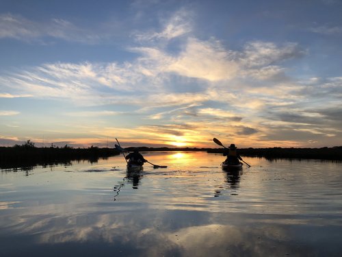
Powderhorn Paddling Trails
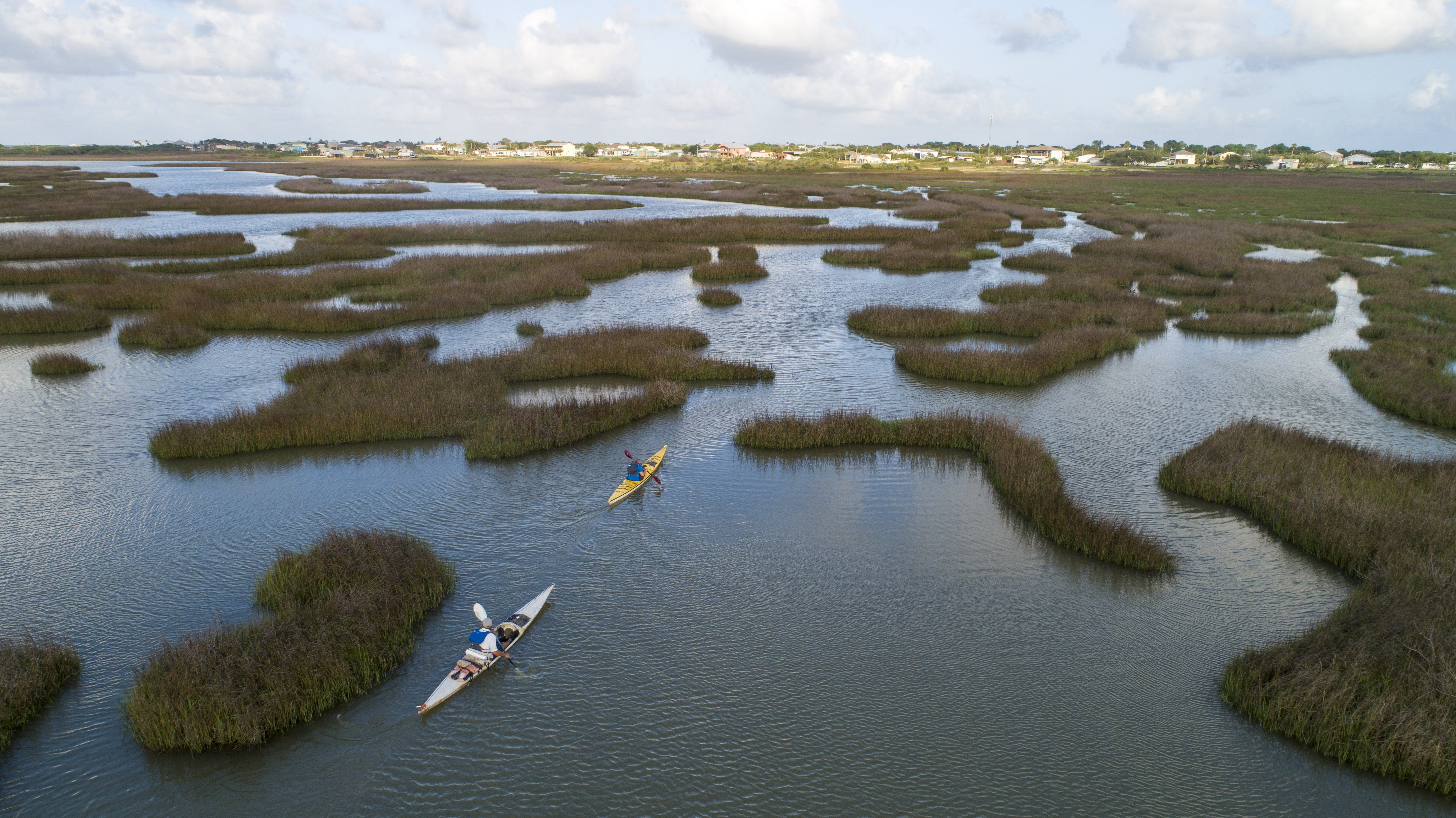
Explore 26 miles of shoreline and marsh trails that surround the Powderhorn Wildlife Management Area and State Park. The trail is divided into 4 shorter trails to choose from: Boggy Bayou Trail, Matagorda Bay Shoreline Trail, Powderhorn Lake Shoreline Loop, and the Coloma Creek Trail.
Trail Access
Boggy Bayou Nature Park
- Type:
- Access Point
- GPS Coordinates:
- 28.4583, -96.4156
Park at Boggy Bayou Nature Park, 3rd Street at Taylor Avenue, Port O'Connor.
Indianola Fishing Marina
- Type:
- Access Point
- GPS Coordinates:
- 28.5117, -96.4880
Park at Indianola Fishing Marina, 8 Bell Street, Port Lavaca. Fee to launch at this site.
Powderhorn RV Park
- Type:
- Access Point
- GPS Coordinates:
- 28.5097, -96.5062
Park at Powderhorn RV Park, 601 Powderhorn Lane, Port Lavaca.
Coloma Creek Bridge (FM 1289)
- Type:
- Access Point
- GPS Coordinates:
- 28.4739, -96.5564
Park near kayak launch at FM 1289 bridge.
Navigating the Trail
Follow this tips and guidelines, and be sure to view our safety information.
Trail Length: 5-13.4 miles (depending on route taken)
Paddling Time: 2-8 hours (depending on route taken, water level, wind speed, and time spent doing other activities like fishing)
Trail includes 4 smaller trails of varying length:
Coloma Creek Trail: 8-miles roundtrip; 4-5 hours
Powderhorn Lake Loop Trail: 13.4-miles; 6-8 hours
Matagorda Bay Shoreline Trail: 5.4-miles (one way); 3-4 hours
Boggy Bayou Trail: 5.4-miles roundtrip; 2-4 hours
Trail Description
Boggy Bayou Trail is a great beginner trail! It's protected with lots of marsh birds including spoonbills, herons, egrets, osprey, and maybe even a rail. On the Matagorda Shoreline Trail, paddlers have the opportunity to explore the shoreline of the future state park to historic Indianola. The Powderhorn Lake Loop Trail gives you the opportunity to paddle around the whole lake, and the adjacent Coloma Creek Trail is a more remote body of water that is more similar to a shallow bay than a creek.
Notes for each trail:
Boggy Bayou Trail: Informational kiosk located at boardwalk. Launch from sandy bayou shoreline and paddle across seagrass filled lake and oyster beds into the backwaters of this productive estuary. High tides or rain events can make launch access problematic.
Matagorda Shoreline Trail: High tides or rain can make the Boggy Bayou launch site problematic. Alternatively launch from Matagorda Bay shoreline just past the boardwalk. Please note that the Matagorda Bay can be exposed to high north or south winds at which time paddling is not recommended.
Powderhorn Lake Loop Trail: Launch from from Indianola Fishing Marina or Powderhorn RV Park. Depending on wind strength and direction, either the north or south shoreline will be exposed. Paddling during windy conditions is problematic.
Coloma Creek Trail: Launch at the Coloma Creek Bridge. Paddle west up the creek where you will experience a wide area first that then narrows down for a quarter mile before entering a second lake. The creek is mostly shallow mud flats.
Private Property
While many coastal trails are adjacent to public lands, much of the area surrounding these four trails is next to private property. Please respect private property by keeping noise levels low, packing out your trash, and staying off adjacent lands without permission. Entrance to the Powderhorn WMA or State Park is through their gates and currently limited, so stay in the water or immediate shoreline and do not enter their property from the shore.
Trail Maps

Things to Do and See
Enjoy fishing, wildlife-watching and natural scenery on this paddling trail. Be sure to check the TPWD Paddling Events Calendar for regularly updated activities. Port O'Connor Chamber of Commerce and Indianola Fishing Marina maintain local event calendars.
Fishing and Wildlife
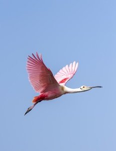
The Powderhorn Paddling Trails offer a diverse range of scenic segments, and paddling allows you to view nature in a quieter manner and from a new perspective. Coastal waters and their associated bays, estuaries and wetlands are a mixing zone for fresh and saltwater. These areas not only enhance water quality and control erosion but they also provide invaluable habitat for juvenile shellfish and finfish during their early life stages. Seagrasses found in this area create high-quality nursery and forage habitat for fish, shrimp, crabs, and other marine life. Birders will observe wading birds, gulls, terns, waterfowl, and occasional wintering Whooping Cranes. Dolphins and sea turtles may be observed in Matargorda Bay and Powderhorn Lake. Alligators can be seen on Boggy Bayou and Coloma Creek - keep a safe distance.
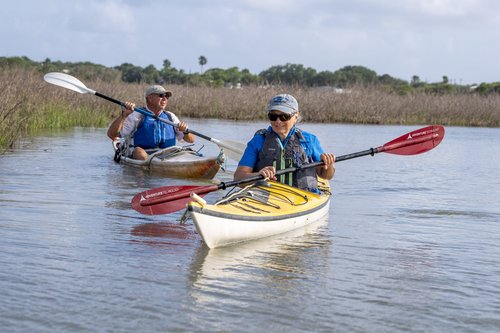
Anglers will enjoy fishing for spotted seatrout, red drum and flounder while paddling along this trail. Sight-casting to “tailing” redfish is a favorite pastime. Live baits (fish and shrimp), soft plastics, spoons and spinner baits are commonly used here.
Rentals and Shuttles
Paddle POC
361-208-0019
Port O'Connor, TX
Kayak rental
Partnership
This trail was made possible through a partnership between Texas Parks and Wildlife Department, Calhoun County, Indianola Fishing Marina, Powderhorn RV Park, and the San Antonio Bay Partnership.