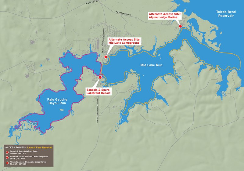
Toledo Bend - Palo Gaucho Bayou Run & Mid Lake Run
Explore 9 miles of paddling in the upper reaches of Palo Gaucho Bayou. This is a long trail where you can access the far reaches of quiet bayou backwaters.
Alternatively, you can head the other direction for the 11-mile Mid Lake Run trail, following the bank towards the main lake, taking in the small coves and creeks along the way and enjoying excellent fishing opportunities.
Trail Access
Sandals & Spurs Lakefront Resort
- Type:
- Access Point
- GPS Coordinates:
- 31.4095, -93.7813
3150 Palo Gaucho Xing (FM 3121)
Hemphill, TX 75948
From the Junction of Texas Highways 87 and 21 in Milam, Texas, drive east on SH 21 for 4 miles. Turn south on FM3121 and go 1.8 miles and turn left into Sandals & Spurs Resorts.
Alternate Access Site: Mid Lake Campground
- Type:
- Access Point
- GPS Coordinates:
- 31.4163, -93.7791
3636 Palo Gaucho Xing (FM 3121)
Hemphill, TX 75948
From the Junction of Texas Highways 87 and 21 in Milam, Texas, drive east on SH 21 for 4 miles. Turn south on FM3121 and go 1.4 miles and turn left into Mid-Lake Campground.
Alternate Access Site: Alpine Lodge Marina
- Type:
- Access Point
- GPS Coordinates:
- 31.4267, -93.7505
3840 Alpine Road
Hemphill, TX 75948
From the Junction of Texas Highways 87 and 21 in Milam, Texas, drive east on SH 21 for 4 miles. Turn south on FM3121 and go .1 mile and turn left (east) onto FM 242. Go 2.0 miles and turn right into Alpine Lodge.
Navigating the Trail

Trail Length: Palo Gaucho Bayou Run: 9 miles
Mid Lake Run: 11 miles
Float Time: Palo Gaucho Bayou Run: 3-5 hours
Mid Lake Run: 4-6 hours
(depending on water level, route taken, wind speed, and time spent doing other activities like fishing)
Please note: Watch for motor boats and stumps. The stretch of trail across the mouth of Palo Gaucho Bayou is expert level paddling due to exposure to wind and waves. Please be sure to paddle at your skill level.
Trail Description
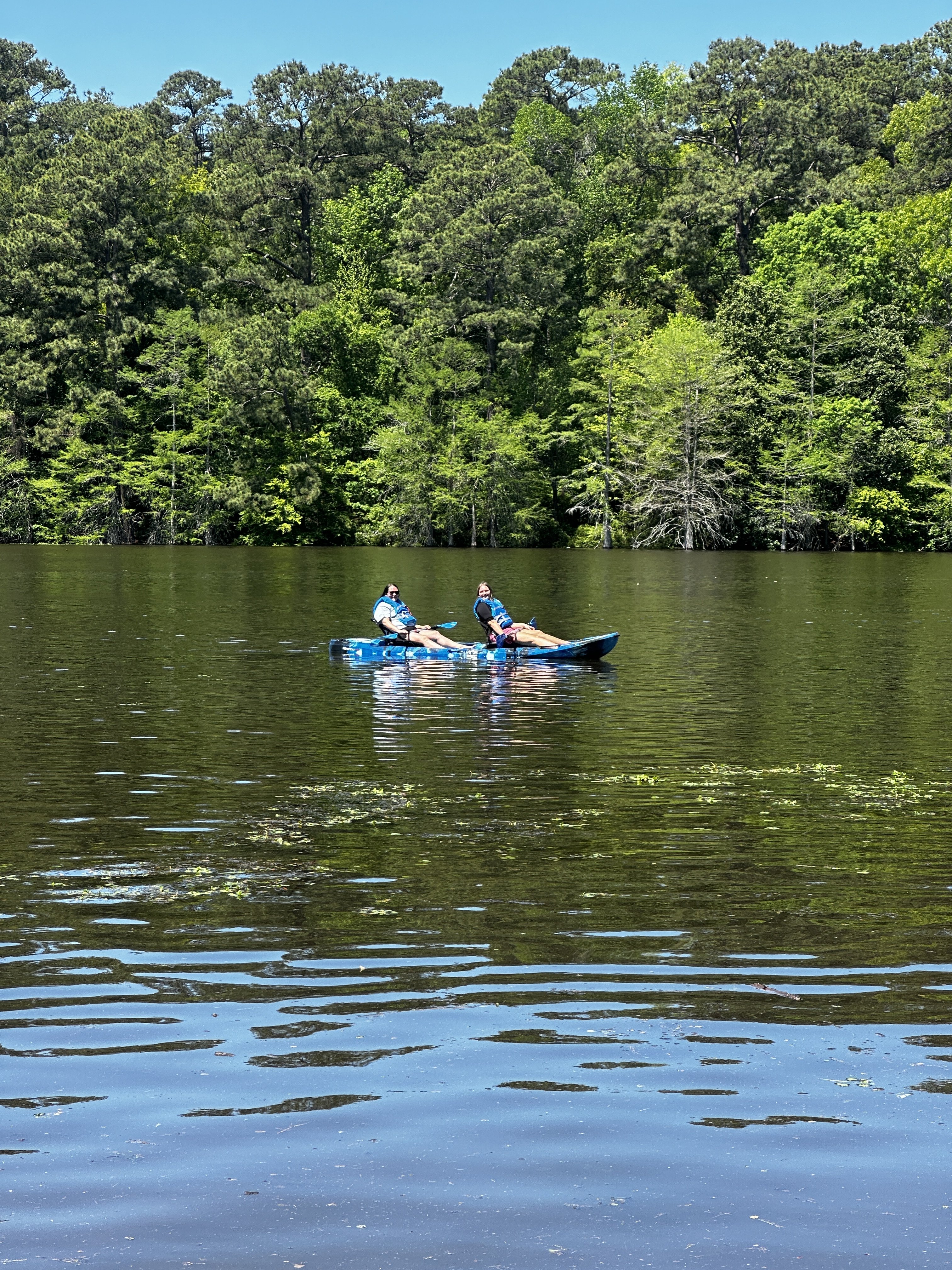
Palo Gaucho Bayou Run: Paddling West towards the back of Palo Gaucho Bayou offers a scenic, classic bayou experience. The remote backwater area is quiet and abundant with wildlife. Fishing is excellent for many species including largemouth bass, and is perfect for fly fishing. Palo Gaucho Bayou is one of several important historical areas formerly occupied by the Caddo peoples.
Mid Lake Run: Paddling East towards outer Palo Gaucho Bayou you'll experience both open waters and quiet creeks on this approximately 9 mile trail. The trail offers excellent fishing opportunities for many species, especially Largemouth Bass and Crappie, throughout the year. Palo Gaucho Bayou is one of several important historical areas formerly occupied by the Caddo peoples.
Private Property
Respect private property by not trespassing or littering and keeping noise levels down. Any use of private river banks or lake shore without permission of the landowner can be considered trespassing. Under Texas Penal Code (§30.05), criminal trespass occurs when one enters property after receiving notice not to enter. Notice includes verbal notice, a fence, sign(s), purple paint on posts or trees, or the visible presence of crops grown for human consumption.
Trail Map
Things to Do and See
Fishing and Wildlife
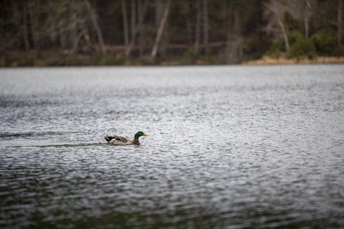
Birdwatching is good all year long. Summertime species include wood ducks, egrets, herons, buntings and storks. Sparrows, mallards, pintails and teals are wintertime inhabitants. Other wildlife present includes squirrel, raccoon, deer, coyote, opossum and feral hog. Remember to keep a safe distance between you and wildlife.
Largemouth bass are the most popular game fish at Toledo Bend. Small lures such as jigs, plastic worms, spinner baits and light-line are generally recommended. Plenty of bluegill and sunfish are present and provide excellent fishing, especially for youth or inexperienced anglers. White bass, crappie and catfish can also be caught. Check Weekly Fishing Reports for timely updates.
Rentals and Shuttles
Toledo Bend Kayak Rental LLC
(936) 201-6495
Partnership
This trail was made possible through a partnership between the Texas Parks and Wildlife Department, Sabine County, and Sabine River Authority.