Stephen F. Austin Paddling Trail - Old Settlement Passage
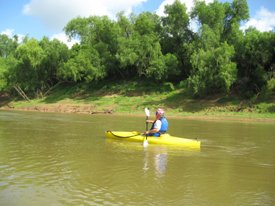
Enjoy a longer paddle along the Brazos River with this 10.4 mile route that offers views of historic bridges along the trail amongst the Columbia Bottomlands.
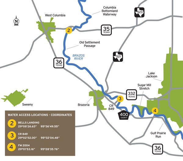
Trail Access
Bells Landing
- Type:
- Put In
- GPS Coordinates:
- 29.1408, -95.6153
From SH 35 at East Columbia, turn southeast onto CR 300-F and follow to end of roadway. Access is down the bank.
CR 849
- Type:
- Take Out
- GPS Coordinates:
- 29.0481, -95.5341
Warning: Due to severe flooding in recent years, the boat ramp at CR 849 is not currently accessible. There are plans to rebuild this ramp, but for now, there is no access at this site. The distance from Bell’s Landing (the put-in for Old Settlement Passage) and FM 2004 boat ramp (the take-out for Sugar Mill Stretch) is 17.3 miles, which may be more than a full day’s paddle. Plan accordingly.
From SH 36 in Brazoria, turn east on FM 521; turn south on CR 400 (just before the bridge). Turn left at the third road (CR 849) and follow to end.
Navigating the Trail
Trail Length: ~10.4 miles
Float Time: ~3.5-4.5 hours (depending on water level, flow rate and wind speed)
Trail Description
At low to moderate flow, paddlers will encounter sweeping bends with numerous drift areas and some sandy beaches. Be careful of quicksand along the banks. Although there are no man-made obstructions on this reach, there may be snags to avoid, especially when water levels are low.
This section of the Brazos River is a natural river that is unrestrained by flood control dams or other man made structures. As such, the Brazos River is readily influenced by rainfall runoff that may create high flows and undesirable water quality conditions. Due to the vast length and extensive basin area of the Brazos River, rainfall does not have to be in the immediate area to significantly impact this section of the river. Flow and water quality information is available to paddlers on the web at http://water.weather.gov/ahps/
Landmark - At Brazoria, the center support of the original bridge rises from near mid-stream. Just down-river and within sight of the old support are the 1939 Highway Bridge, the 1907 railway bridge, and the new FM 521 bridge. The CR 849 landing is approx. two miles below the railroad bridge, at the apex of a loop in the river. Watch for a gravel bank on the west bank.
Find information on three additional paddling trails along the Brazos River that are connected to this trail at the following websites: Columbia Bottomland Waterway, Sugar Mill Stretch, and Gulf Prairie Run.
Private Property
Respect private property by not trespassing or littering and keeping noise levels down. This river and lake are classified as navigable, which permits public use of the streambed and, if necessary, the banks to portage any hazard. Any other use of private river banks without permission of the landowner can be considered trespassing. Under Texas Penal Code (§30.05), criminal trespass occurs when one enters property after receiving notice not to enter. Notice includes verbal notice, a fence, sign(s), purple paint on posts or trees, or the visible presence of crops grown for human consumption.
Trail Map
Things to Do and See

Fishing
This section of the river supports numerous freshwater species of catfish, sunfish, and alligator gar; as the river moves toward high tide, the influx of saltwater brings with it redfish, sand trout, flounder, and other saltwater fish. Small lures such as jigs, plastic worms, spinner baits and light-line are generally recommended.
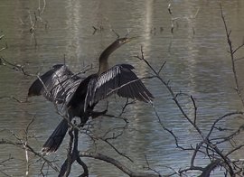
Wildlife and Ecology
The riparian corridor of the Brazos River supports a great diversity of plant and animal life along the river and beyond the banks. Birds spotted here include many species of migratory birds which vary according to the season. Several varieties of native trees grow along the river, including live oak, ash, pecan, cottonwood, cypress, and elm. Common wildlife encountered include alligators, deer, and small mammals. It is not unusual to see livestock watering in the river.
Partnership
This trail was made possible through a partnership between Texas Parks and Wildlife Department and Brazoria County Parks Department