Ecologically Significant River and Stream Segments
Cedar Lake Creek
Figure 18. Map Location of Cedar Lake Creek
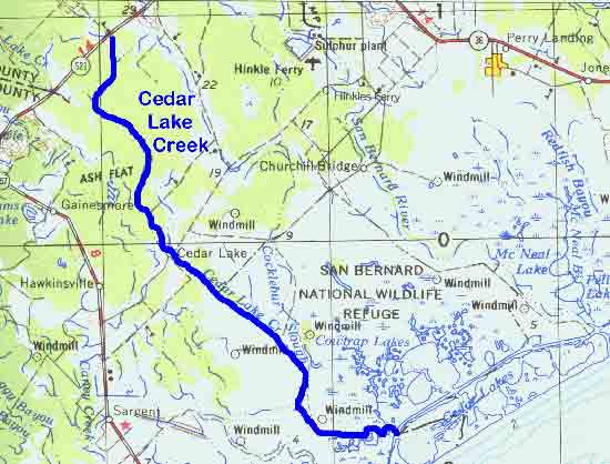
Adapted from USGS Bay City, Texas. 1974. Original scale 1:250,000.
Figure 19. (a)Cedar Lake Creek at FM 2611 (b) at the San Bernard National Wildlife Refuge
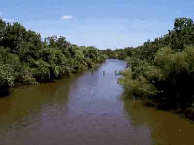
(a) |
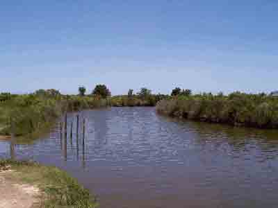
(b) |
Cedar Lake Creek
Cedar Lake Creek begins in northwest Brazoria County and flows southeasterly 28 miles into Cedar Lake and ultimately to the Gulf of Mexico. The creek is bordered by bottomland hardwood forest in the northern portion and by interspersed native prairies, farmland, and coastal marshes in the south. It is one of the few remaining unchannelized bayous in the region. Approximately 3,500 acres of forested land along three miles of creek are in the process of being acquired as a Wildlife Management Area. The creek itself and the adjacent San Bernard National Wildlife Refuge provide habitat to numerous bird species including the scissor-tailed flycatcher and numerous shorebirds. The ecologically significant segment is from the confluence with the Intracoastal Waterway in Brazoria County upstream to FM 521 in Brazoria County.
(1) Biological Function- undredged bayou with extensive forest and wetlands that display significant overall habitat value.15,16
(2) Hydrologic Function- bottomland forest and wetlands perform valuable hydrologic functions relating to flood attenuation and water quality.
(3) Riparian Conservation Area- fringed by San Bernard National Wildlife Refuge and is part of the Great Texas Coastal Birding Trail.
(4) Threatened or Endangered Species/Unique Communities- significant due to presence of reddish egret, wood stork, brown pelican, and white-faced ibis.23