Ecologically Significant River and Stream Segments
Mill Creek
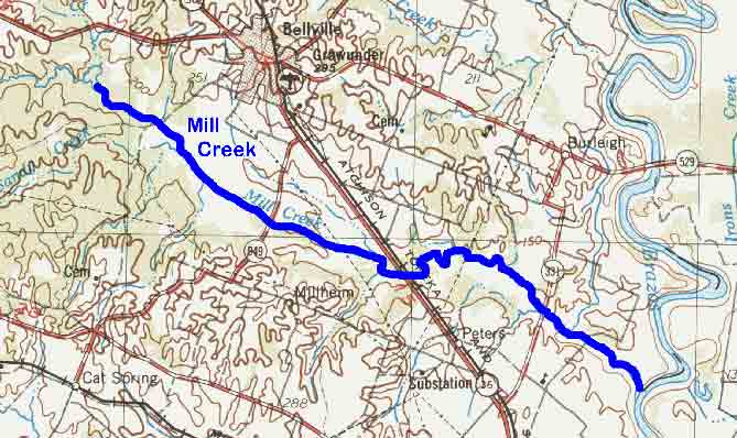
Figure 38. Map Location of Mill Creek

Adapted from USGS Seguin, Texas. 1975. Original scale 1:250,000.
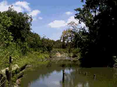
Figure 39. Mill Creek west of FM 331

Mill Creek
Mill Creek forms west of Bellville where West Mill and East Mill Creek’s join in southern Washington County and flows southeasterly across Austin County to the Brazos River northeast of Sealy. The creek’s channel is narrow and shallow with a sandy substrate and numerous sandbars. The creek follows a meandering path through interspersed pasture land and hardwood forest floodplain and provides habitat for a diverse fish community including spotted gars, minnows, common carp, river carpsuckers, channel catfish, and several sunfish species.11 The surrounding area is known as the Katy Prairie and is one of the country’s premier wintering waterfowl regions despite virtually all of the grassland having been converted to rice fields. The rice fields act as artificial wetlands that attract migrant shorebirds such as the American golden-plover, Hudsonian godwit, pectoral sandpiper and the buff-breasted sandpiper. The bottomland forest that surrounds much of the creek provides habitat for numerous woodland birds such as wrens, sparrows, vireos, warblers and Eastern bluebirds. The ecologically significant segment is from the confluence with the Brazos River upstream to the point where it is formed by West Mill and East Mill Creeks.
(1) Biological Function- high biodiversity that displays significant overall habitat value.11,16
(2) Hydrologic Function- performs valuable hydrologic functions relating to water quality and groundwater recharge of the Chicot Aquifer.20
(3) High Water Quality/Exceptional Aquatic Life/High Aesthetic Value- identified as an Ecoregion Reference Stream by the TPWD River Studies Program due to high dissolved oxygen and biodiversity of benthic macroinvertebrates.2
(4) Threatened or Endangered Species/Unique Communities- rare gammagrass-switchgrass bottomland tallgrass prairie.1
(Back)