- The State of the Gulf of Mexico (July 2008)
- The State of Lakes (July 2007)
- The State of Wetlands (July 2006)
- The State of Springs (July 2005)
- The State of Rivers (July 2004)
- The State of Bays (July 2003)
- The State of Water (July 2002)

The State of Water in the Pineywoods

The Pineywoods receives the highest average rainfall in the state and is home to bottomlands hardwoods, one of the state's most diverse and threatened ecosystems.
Major Water Challenge: Dependence on Caddo Lake by cities and industry. Water-short cities are looking to water-rich rural areas for future supplies.
Water Resource Problems: Manufacturing needs will increase; industrial pollution and high mercury levels caused fish consumption advisories in two reservoirs.
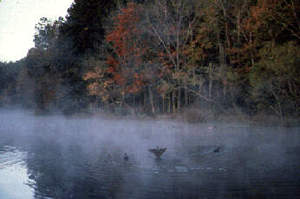
Here green cathedrals of loblolly and shortleaf pines tower over East Texas highways and byways, while blossoming dogwoods and redbuds herald the spring. Slow-moving rivers drift under stands of moss-draped stately cypresses, and the calls of myriad birds echo through the woods and across scattered swamps.
This rich environment supports 101 species of birds that breed in East Texas and 116 species of fish that inhabit East Texas bottomlands during seasonal flooding. The Pineywoods is home to the rare Red-cockaded woodpecker, which can be heard drumming on large, mature pines.
Streams wander between the hills and across the plains, through banks lined with pines, hardwoods and brush. Leaf litter and muddy bottoms cause the water to be cloudy, but they also add vital nutrients, providing for a healthy ecosystem.
East Texas streams include a number of different habitats such as riffles, runs, open water pools and sloughs, as well as oxbow lakes (remnants of streams cut off from the main channel).
Bottomlands in East Texas include forested wetlands, swamps, marshes, seeps and oxbow lakes. Seasonal flooding of rivers and streams shape bottomlands and affect the number and types of plants found in these areas. Bottomland plants help hold soil in place, preventing erosion and filtering pollutants from the water.
Timber and cattle production are important industries in the region. Farms and ranches are relatively small in size compared to the state average. The average annual rainfall of 36 to 50 inches is fairly uniformly distributed throughout the year, and humidity and temperatures are typically high. Elevations range from 200 to 500 feet above sea level.
Water Supply and Demand
Supply
Major River: Sabine, Cypress, Sulphur, Red
Major Aquifer: Carrizo-Wilcox
Use & Demand
- 88% demand met through surface water.
- 57%demand is manufacturing, 22% municipal.
- By 2050, manufacturing demand is expected to change to 61% for manufacturing, 16% municipal and 14% power needs.
- Municipal and manufacturing use of shallow groundwater is a problem due to acidic conditions and high concentrations of iron in the water. Surplus water is being sold to the Dallas Water Utilities. (Source: Texas Center for Policy Studies. Texas Environmental Almanac (Austin: U.T. Press, 2002), 21-26.)
Major Cities - Rainfall / Elevation
Regional Average Rainfall: 40-52 in./yr
Regional Average Net Evaporation rate: 16-32 inches
The average annual rainfall is fairly uniformly distributed throughout the year, and humidity and temperatures are typically high. Elevations range from 200 to a little over 500 feet above sea level. Data source: National Climate Datat Center, U.S. Dept of Commerce.
Alto - 45.63 in / 433 ft
Atlanta - 48.83 in / 264 ft
Canton - 44.56 in / 540 ft
Carthage - 51.51 in / 302 ft
Jacksonville - 46.05 in / 560 ft
Longview - 49.06 in / 3309 ft
Marshall - 51.22 in / 352 ft
Nacogdoches - 48.36 in / 283 ft
San Augustine - 53.92 in / 304 ft
Texarkana - 51.24 in / 390 ft
Tyler - 45.27 in / 558 ft
Woodville - 55.70 in / 232 ft