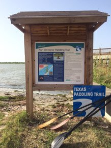
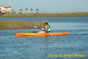
Port O’Connor Paddling Trail
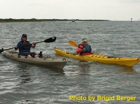
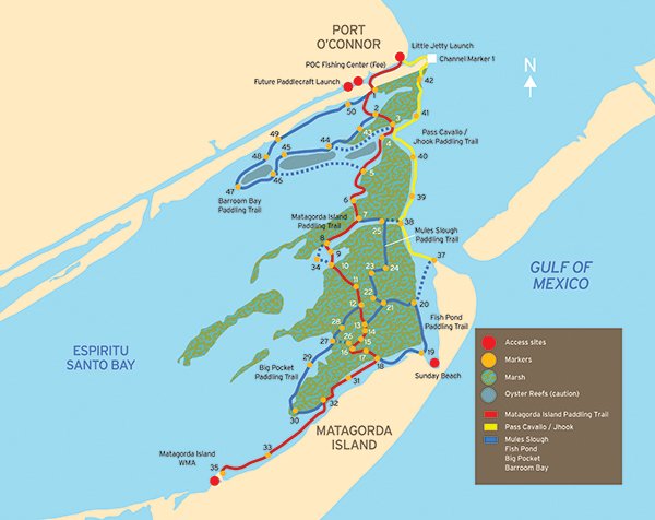
The Port O'Connor Paddling Trail consists of six shorter trails along 40 miles of trail. The Port O'Connor Paddling Trail consists of a series of six interconnecting trails navigating 40 miles of trail along the shores of Espiritu Santo and Matagorda Bays and through their boundary saltwater marsh Mules Slough/Fish Pond. The Trail offers opportunities to paddle several hours, all day, or several days as well as opportunities to bird, fish and relax. The main spine trail, called the Matagorda Island Trail terminates near the picnic area on Matagorda Island that is managed by Texas Parks and Wildlife Department as a Wildlife Management Area.
Trail Access
Little Jetties Initial Access
- Type:
- Access Point
- GPS Coordinates:
- 28.4448, -96.4022
The Little Jetties site is located on public right of way where Washington Street dead-ends into the Gulf Intracoastal Waterway. A small parking lot is available. The closest public restroom is located at Kingfisher Park on Park Street.
Directions once in Port O’Connor:
- Continue east on Hwy 185 / Adams Street to S 2nd Street.
- Hwy 185 turns right at S 2nd Street; make the turn right.
- Continue on Hwy 185 / S 2nd Street for 4 blocks.
- Turn left on Commerce Street.
- The Little Jetties put-in is at the intersection of Commerce Street and Washington Street and the Gulf Intracoastal Waterway (GIW).
- The Pass Cavallo Trail heads east around the south jetty (GIW 1). Marker #1 of the Matagorda Island Trail is 1.1 miles west in the GIW at Fisherman’s Cut.
The Fishing Center Initial Access
- Type:
- Access Point
- GPS Coordinates:
- 28.4386, -96.4140
303 W Water Street at corner of S 13th
Phone: 361-983-4440
The Fishing Center is a privately owned boat ramp and bait stand offering a ramp and parking. Fishing supplies, snacks and drinks, and ice are available for purchase. A restroom is available in the store. The Fishing Center offers the closest access to Marker #1 at Fisherman's Cut (0.9 miles closer than Little Jetties) which provides access to the 'Back Bay' system.
Directions once in Port O’Connor:
- Turn right on S 16th Street (at Speedy Stop Convenience Store).
- After several blocks, turn left on Maple Street, then right on 15th Street.
- The Fishing Center is located at the corner of 15th Street, Water Street, and the GIW.
- To get to Marker #1, paddle across the GIW and enter Fisherman’s Cut.
Froggies Initial Access
- Type:
- Access Point
- GPS Coordinates:
- 28.4320, -96.4329
Navigating the Trail
Follow this tips and guidelines, and be sure to view our safety information.
Paddling Time: estimate 1-2 miles/hour on each trail (depending on water levels, wind speed, and paddler's skill level)
Trail includes 6 smaller round-trip loop trails of varying length:
Matagorda Island Trail: ~25 miles
Pass Cavallo/J-hook Trail: ~11 miles
Barroom Bay Trail: ~8 miles
Mules Slough Trail: ~13 miles
Fish Pond Trail: ~16 miles
Big Pocket Trail: ~17 miles
For those paddling the Matagorda Island Trail to the Matagorda Island Wildlife Management Area there is primitive campsite available, but there is no automobile access to Matagorda Island.
Trail Description
The paddling trails wind through several bayous and across open water giving you opportunities to paddle several hours, all day, or several days depending on the route you choose. Regardless of your route, the trails are interconnected. The Matagorda Island Trail eventually ends at the campground at Matagorda Island, and because of the distance, a roundtrip to the island in one day is not recommended. Camping is available at the campground.
Safety
Wear your lifejacket, and take plenty of sunscreen and insect repellant. Plan your trip to make sure you have plenty of water. Watch for faster moving powerboats and oyster reefs that can damage your kayak. Check the tides before you depart, since some trails may not be floatable at low tides, and always know the local weather forecast. Wind is the biggest potential hazard as the trail is subject to periodic strong winds: southerly in the spring and summer and northerly in the winter and spring. The weather can change rapidly, especially from strong northers in Fall through Spring, so pay attention to the forecast. Current tidal conditions and forecasts are available online. Generally speaking, tides above 1’ will allow you to paddle throughout the Paddling Trail, and those below 0.0’ may require you to pull your kayak across occasional shallow spots. The area is also popular with waterfowl hunters.
NOTE: Motorboat activity is high on portions of this trail. Use caution at all times, especially between Marker 2 and Marker 3 of the Matagorda Island Trail.
Respect Private Property
While many coastal paddling trails are adjacent to public lands, some are adjacent to private property. Respect private property by not trespassing or littering and keeping noise levels down. Use of private land adjacent to the water without permission of the landowner can be considered trespassing. Under Texas Penal Code (30.05), criminal trespass occurs when one enters property after receiving notice not to enter. Notice includes verbal notice, a fence, sign(s), purple paint on posts or trees, or the visible presence of crops grown for human consumption.
Trail Maps
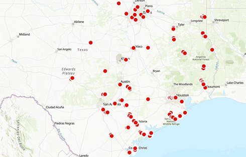
Global Positioning System (GPS) points for Port O'Connor
Things to Do and See
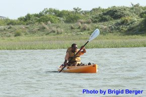
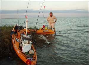
Enjoy fishing, wildlife-watching and natural scenery on this paddling trail. Be sure to check the TPWD Paddling Events Calendar for regularly updated activities.
Matagorda Island
The main paddling trail ends at Matagorda Island. The 56,688-acre island is a Wildlife Management Area that is cooperatively managed by Texas Parks and Wildlife Department and the U.S. Fish and Wildlife Service. The island is approximately 38 miles long and from one to four miles wide.
Use of the picnic area near paddling sign #35 is permissible for day-use as long as you stay in the campground area. While there are picnic tables at the site, there is no water or restrooms. If you choose to camp overnight or you want to hike, bike or tour the island for any reason, you must possess either a Limited Public Use Permit or an Annual Public Hunting Permit. The permits can be purchased at any place that sells hunting or fishing licenses. For questions about rules governing use of the island, contact the Texas Parks and Wildlife Department at 979-244-7697.
Wildlife and Ecology
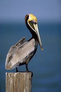
The small islands that border the trail and Matagorda Island support a wide variety of shore and migratory birds and 19 federally listed threatened or endangered species. The small islands that border the trail and Matagorda Island support a wide variety of shorebirds and migratory birds, including pelicans, herons, egrets, Roseate Spoonbills, ducks, Sandhill Cranes, grebes, loons, gulls, terns, willets, curlews, and plovers. The Atlantic bottlenose dolphin is spotted along the trail, and a large heard of whitetail deer can sometimes be seen on Matagorda Island, along with the occasional alligator. The area is known for producing redfish, speckled trout, drum and other popular fish. Trout and large redfish are commonly caught all year long.
Conservation
Coastal waters and their associated bays, estuaries, and wetlands are mixing zones for fresh and saltwater. These areas not only enhance water quality by assimilating domestic waste and controlling erosion but they also provide invaluable habitat for juvenile shell and game fish (or finfish) during their early life stages. These areas also support various municipal and industrial facilities and support diverse fish and wildlife, fishing, hunting, and other recreational activities which positively affect Texas' economy. Freshwater inflows must be maintained in order to produce balanced salinity levels. Conservation of our bays and estuaries can be furthered through efforts to preserve and restore wetlands and seagrasses to reduce erosion, filter pollutants and improve water quality. Conservation of these areas ensures that the natural heritage of Texas is protected for future generations.
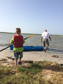
Rentals and Shuttles
PaddlePOC
Kayak rentals and shuttles.
25 Scurlock Dr., Port O'Connor, TX 77982
info@paddlepoc.com
R&R Guide Service
Capt. Jim Reed offers Kayak Transportation, Matagorda Island Shuttles, Bay Fishing Charters, Island Shuttles, Birding; Bay Cruises.
(361) 648-5688 or (361) 648-5877
jimrreed3@gmail.com
Local Shuttles to Matagorda Island
The Port O'Connor Chamber of Commerce website maintains an up-to-date list of shuttle services.
Partnership
This trail was made possible through a partnership between Texas Parks and Wildlife Department, POC Chamber of Commerce, Calhoun County, West Side Calhoun County Navigation District, and the San Antonio Bay Partnership.