Christmas Bay Paddling Trail
Christmas Bay Paddling Trail is a 19.1-mile circumnavigation of this pristine minor bay on the western end of the Galveston Bay complex. Easily accessible from the Houston metropolitan area, the Christmas Bay Paddling Trail offers popular, shorter loops of 3.8 and 10.3 miles with outstanding coastal angling and bird watching opportunities.
Trail Access
Amigo Lane
- Type:
- Access Point
- GPS Coordinates:
- 29.0489, -95.1656
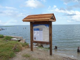
Trail marker sign is located near the boat ramp.
Former Site of Ernie’s Too Bait Camp (bait camp no longer open)
515 Amigo Ln, Freeport, TX 77541, US
979-233-5159
San Luis County Park
- Type:
- Access Point
- GPS Coordinates:
- 29.0786, -95.1306
14001 CR 257 Freeport, TX 77541
979-233-6026
Located on the right side of Bluewater Hwy 257- turn right after you cross the San Luis Bridge and follow the dirt road down to the park and boat dock.
Navigating the Trail
Follow this tips and guidelines, and be sure to view our safety information.
Trail Description
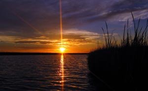
Christmas Bay is a shallow 4,173 acre embayment in the southwestern portion of the Galveston Bay system. The bay has good water quality, extensive oyster reefs, and fringing salt marsh habitat consisting of Spartina alterniflora, Batis maritima, and other species, and has not yet been greatly altered by human activity. The northern shore of the bay is home to the 42,000-acre Brazoria National Wildlife Refuge.
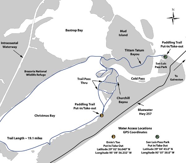
The paddling trail is marked by 29 numbered GPS markers and includes routes along Churchill Bayou and Titlum Tatlum Bayou. Total trail length is 19.1 miles. Popular shorter routes include marker sequence: 1, 2, 22, 21, 20, 18, 17, 7, 6, 5, 4, 3, 2, 1 for a distance of 3.8 miles, and marker sequence: 1, 23, 24, 25, 26, 27, 28, 29, 10, 9, 3, 2, 1 for a total of 10.3 miles. (See maps section for location of points.)
Safety
For Christmas Bay, take plenty of sunscreen, water and insect repellent. If wadefishing, wear ray-proof wading boots or shuffle your feet carefully to avoid a stingray strike. Christmas Bay is very shallow and most paddlers can comfortably stand in its waters in most areas. Power boat traffic on this body of water is minimal.
Trail Maps
Things to Do and See
Enjoy fishing, wildlife-watching and natural scenery on this paddling trail. Be sure to check the TPWD Paddling Events Calendar for regularly updated activities.
Fishing
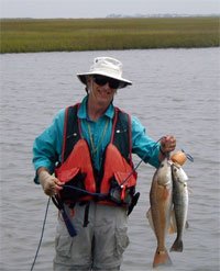
Anglers will enjoy fishing for spotted seatrout, red drum and flounder, and much of the shallow bay features a bottom firm enough to wade.
Wildlife and Ecology
The bay supports a higher diversity of finfish than any other portion of the Galveston Bay estuary and has been designated a nursery area and a Coastal Preserve by TPWD. On the preserve, the Texas quahog (Mercenaria texana), an edible species of hard clam, inhabits the shallow-water perimeters.
The area is home to migratory and resident waterfowl and shorebirds. Stands of cordgrass provide feeding and nesting habitat for waterbirds, and extensive oyster reefs are found in the bay.
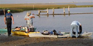
Rentals and Shuttles
SouthWest PaddleSports
26322 I-45 North - Exit 76A
The Woodlands, Houston, Texas, 77386-1022
Phone: (281) 292-5600
Visit http://www.paddlesports.com
Artist Boat
Guided Paddling Tours - Artist Boat's professional, interpretive staff of certified kayak instructors will lead you to great places via kayak, identify and show you native species, teach water coloring techniques, assist you with developing paddling skills, and interpret natural processes. Join us to explore the natural wonders of Galveston Bay. No experience necessary. Reservations required. Call 409-770-0722. Visit https://www.artistboat.org/events/
Partnership
The Christmas Bay Paddling Trail is maintained in partnership with the Paddling Anglers in Canoes and Kayaks (P.A.C.K.). If you are interested in where to fish or have other questions, they may be contacted by email or visit their website for more information.