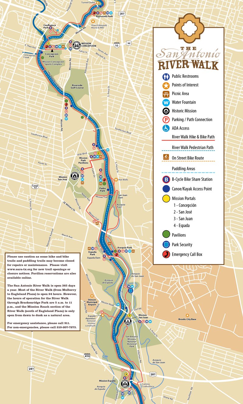
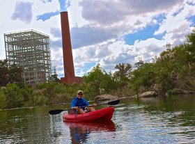
Mission Reach Paddling Trail
Enjoy an 8-mile long trail from Roosevelt Park downstream to the Camino Coahuilteca takout by Mission Espada for a very special view of San Antonio’s mission region.
Trail Access
Roosevelt Park
- Type:
- Access Point
- GPS Coordinates:
- 29.4015, -98.4883
Mission Road and Lone Star Blvd.
VFW Blvd
- Type:
- Access Point
- GPS Coordinates:
- 29.3702, -98.4761
Parking at NW corner of VFW Blvd. and San Antonio River
Padre Park
- Type:
- Access Point
- GPS Coordinates:
- 29.3622, -98.4698
Parking at dead end of Park Rd. off of Padre Drive
Espada Park
- Type:
- Access Point
- GPS Coordinates:
- 29.3477, -98.4663
South of SE Military on Mission Parkway
Camino Coahuilteca
- Type:
- Access Point
- GPS Coordinates:
- 29.3196, -98.4489
South of Loop 410 between Espada Road and Villamain
Navigating the Trail
Trail Length: 8 miles from Roosevelt Park to Camino Coahuilteca
Float Times: 3-5 hours (full 8-mile trail; dependent on water levels and flow rate)
Note: There are opportunities to take out at alternate access sites sooner if necessary.
Trail Description
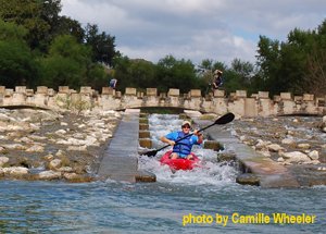
The 8-mile Mission Reach Paddling Trail flows from just south of Downtown San Antonio through over 400 acres of restored riparian habitat and is bordered by 15 miles of hike and bike trails, City parks, County Parks, and San Antonio Missions National Historical Park. There are 30+ “Canoe Chutes” that will allow vessels to pass through riffles during low flow levels. Access points are marked by Blue buoys on the waters edge that can be seen from both the hike and bike trail as well as the water.
The San Antonio River is a natural river that is unrestrained by flood control dams or other man made structures. As such, the Mission Reach of the San Antonio River is readily influenced by rainfall runoff from the urban area that surrounds it. 72 hours following rain events, paddlers should expect high flows and undesirable water quality conditions. Flow and water quality information is available to paddlers on the web at www.sara-tx.org.
Trail Map
Things to Do and See
Fishing
Common gamefish found in the Mission Reach are Largemouth Bass, and multiple species of Catfish and Sunfish. Since most of the River is exposed fish will gravitate toward shaded areas. Small lures such as jigs, plastic worms, spinner baits and light-line are recommended.
Wildlife and Ecology
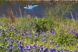
The riparian corridor of the San Antonio River supports a great diversity of plant and animal life along the river and beyond the banks. Birds spotted here include Neotropical and Double Crested Cormorants, Many species of Egrets and Herons. Over 200 species of native plants reside along the banks of the Mission Reach of the San Antonio River, and as part of the Ecosystem Restoration Project over 23,000 trees have been planted along this 8-mile section of river.
Rentals and Shuttles
Approved Paddling Vendors within San Antonio City Limits
Available on the San Antonio River Authority website.
Partnership
This trail was made possible through a partnership between Texas Parks and Wildlife Department, San Antonio River Authority, Bexar County, City of San Antonio, and San Antonio Missions National Historical Park.