West Gulf Coastal Plain Chenier and Upper Texas Coast Fringe Forest and Woodland
Geology
This system occupies Quaternary deposits associated with migrating shorelines, shell ridges, and coastal salt domes. The Ingleside Barrier strandplain, an ancient barrier ridge composed of deep sands and occurring well inland of the current Gulf shoreline, may have occurrences of this system associated with it.
Landform
Most occurrences occupy ridges formed from sediments deposited along ancient shorelines. These ridges, which often parallel the coast and are composed of coarse material such as sand or shell, may be up to 3 meters above mean sea level. Some occurrences occupy coastal salt domes, which may rise 30 meters above the surrounding landscape.
Soils
Soils are typically entisols of coarse textured material, either sand or shell. The Ecological Site Description, which may be related to this system, is the Coastal Sand ecoclass.
Parent Description
This woodland occupies sand and shell ridges which resulted from ancient abandoned beach ridges. It may also be found on salt domes near the coast. Typically these forests and woodlands are dominated by Quercus virginiana (coastal live oak), however other species such as Celtis laevigata (sugar hackberry) and Quercus nigra (water oak) may be present to codominant in the canopy. Other species such as Liquidambar styraciflua (sweetgum), Carya illinoinensis (pecan), Diospyros virginiana (common persimmon), Fraxinus pennsylvanica (green ash), and Magnolia grandiflora (southern magnolia) may also be present in the canopy. The understory is often patchy but may include species such as Ilex vomitoria (yaupon), Callicarpa americana (American beautyberry), Zanthoxylum clava-herculis (Hercules-club pricklyash), Crataegus viridis (green hawthorn), Sabal minor (dwarf palmetto), Morella cerifera (wax-myrtle), and/or Sideroxylon lanuginosum (gum bumelia). Woody vines present in this system include Vitis mustangensis (Mustang grape), Parthenocissus quinquefolia (Virginia creeper), Campsis radicans (trumpet creeper), and Toxicodendron radicans (poison ivy). The two epiphytes, Tillandsia usneoides (Spanish moss) and Pleopeltis polypodioides (resurrection fern), may be commonly encountered in this system. The herbaceous layer is usually sparse, but may include species such as Schizachyrium scoparium (little bluestem), Sanicula canadensis (Canada snakeroot), Malvaviscus arboreus var. drummondii (Drummond turk’s cap), Elephantopus carolinianus (leafy elephantfoot), and Oplismenus hirtellus (basketgrass). Areas that were mapped tended to represent wetter areas than are typical of this type, with species such as Quercus phellos (willow oak) and Quercus laurifolia (laurel oak) conspicuous in the canopy. Triadica sebifera (Chinese tallow) and Ligustrum sinense (Chinese privet) may be important non-native invaders into this system.
Ecological Mapping Systems
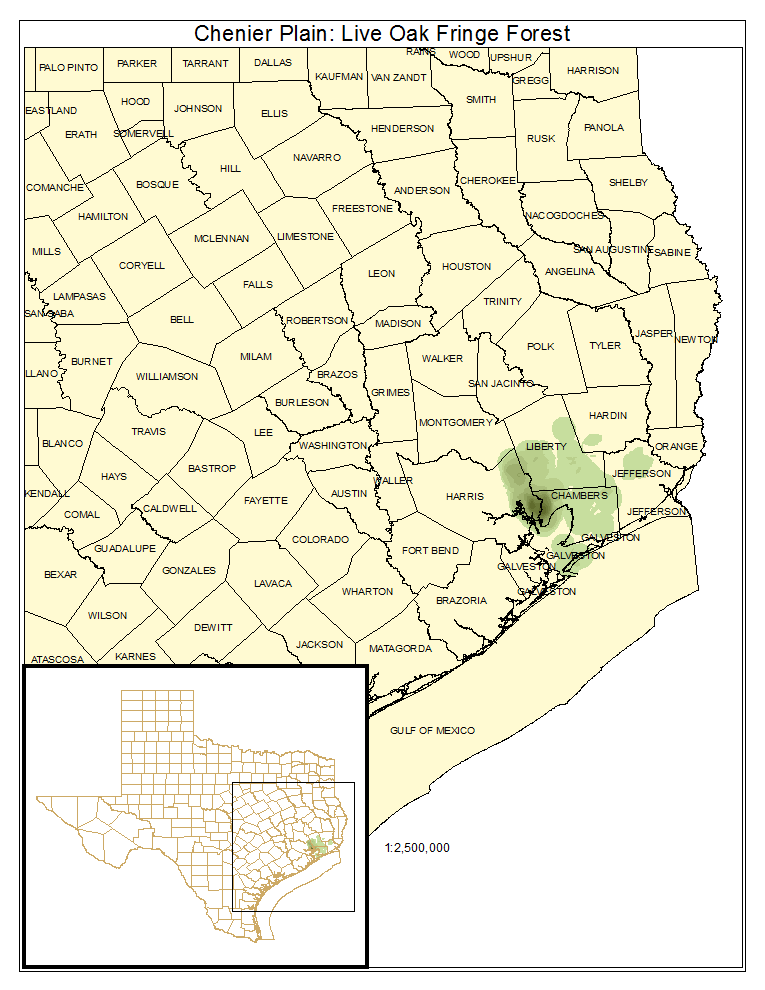
Chenier Plain: Live Oak Fringe Forest
Occurrences of this type are dominated by Quercus virginiana (coastal live oak). About 3% of this system was mapped as this type.
Distribution Map

Photos

Public Land Occurrence
- None.
Chenier Plain: Mixed Live Oak / Deciduous Hardwood Fringe Forest
This represents the mixed deciduous - evergreen vegetation type for this system.
Distribution Map

Photos

Public Land Occurrence
Chenier Plain: Hardwood Fringe Forest
This represents the deciduous vegetation type for this system. Evergreen species may be present, but the deciduous component is the clear dominant.
Distribution Map

Photos

Public Land Occurrence
- None.