Texas Saline Inland Prairie
Geology
This system often occurs on Quaternary alluvium, sometimes juxtaposed with Eocene deposits of the Jackson Group or Yegua Formation.
Landform
Relatively level sites, typically within floodplains.
Soils
Soils are often mapped as the Salty Prairie Ecological Site type.
Parent Description
This typically herbaceous system occupies soils of relatively high salinity. In contrast to Texas Saline Coastal Prairie, soil salinity of sites occupied by this system result from deposition of salts from the surrounding landscape into alluvial sites where repeated flooding and evaporation bring salts to the surface. Spartina spartinae (Gulf cordgrass) typically dominates these sites, sometimes to the near exclusion of other species. Other species that may be encountered include Sporobolus virginicus (seashore virginicus), Distichlis spicata (saltgrass), Monanthochloe littoralis (shoregrass), Paspalidium geminatum (Egyptian paspalidium), Chloracantha spinosa (spiny aster), Coreopsis tinctoria (plains coreopsis), Heliotropium curassavicum (seaside heliotrope), Isocoma drummondii (Drummond goldenweed), Borrichia frutescens (sea ox-eye daisy), and Helianthus ciliaris (blue-weed). Shrubs such as Prosopis glandulosa (honey mesquite), Prosopis reptans (tornillo), Lycium carolinianum (Carolina wolfberry), and Opuntia engelmannii var. lindheimeri (Lindheimer pricklypear) may be present. Occasionally shrubs, particularly Prosopis glandulosa (honey mesquite), may gain sufficient cover to be mapped as a shrubland. Dense stands of Chloracantha spinosa (spiny aster), Isocoma drummondii (Drummond goldenweed), or Borrichia frutescens (sea ox-eye daisy) may also be mapped as shrubland, and these sites may also have a sparse overstory of Prosopis glandulosa (honey mesquite).
Ecological Mapping Systems
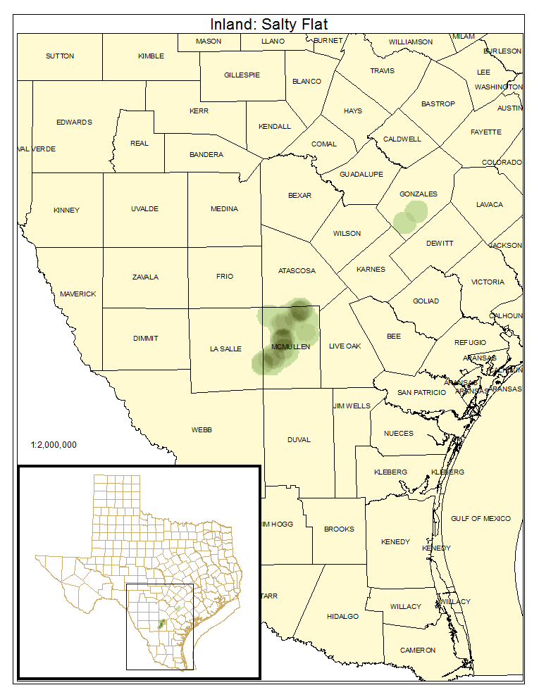
Inland: Salty Flat
Inland saline sites that are unvegetated or sparsely vegetated are mapped as this type.
Distribution Map

Photos

Public Land Occurrence
- None.
Inland: Salty Prairie
This is the typical herbaceous type often dominated by Spartina spartinae (Gulf cordgrass).
Distribution Map

Photos

Public Land Occurrence
- None.
Inland: Salty Prairie Shrubland
This type may have significant cover of Prosopis glandulosa (honey mesquite). Or, in some cases, dense cover of Chloracantha spinosa (spiny aster), Isocoma drummondii (Drummond goldenweed), or Borrichia frutescens (sea ox-eye daisy) may be mapped as this type.
Distribution Map

Photos

Public Land Occurrence
- None.