Western Great Plains Closed Depression Wetland
Geology
This system typically occurs on various formations of the tablelands of the High Plains.
Landform
Internally draining depressions, typically on the tablelands of the High Plains, including the Llano Estacado, and outliers of those level plateaus.
Soils
These basins are typically lined by vertisols and may be mapped as Playa, Lakebed, or in some cases Clay Flat ecoclasses.
Parent Description
As mapped, this system represents the playas of the southern Great Plains. They are shallow, small (averaging about 6 ha), generally circular, recharge basins receiving moisture from rainfall within internally draining watersheds and lacking significant overland drainage from the basins. They are usually characterized as occupying Vertisols with a clay layer of reduced permeability, and are variably wet and dry depending on local weather conditions. Moisture accumulation occurs through overland flow of rainfall falling on the surrounding, internally draining watershed, and drying results from evaporation, transpiration, and infiltration, with playas representing a significant recharge feature of the Ogallala Aquifer. This system is typically dominated by herbaceous vegetation including species such as Pascopyrum smithii (western wheatgrass), Bouteloua dactyloides (buffalograss), Eleocharis macrostachya (pale spikerush), Panicum obtusum (vine mesquite), Helianthus ciliaris (blue-weed), Phyla nodiflora (common frog-fruit), Oenothera canescens (beakpod eveningprimrose), Chenopodium leptophyllum (narrowleaved goosefoot), Ambrosia grayi (woollyleaf burr ragweed), Polygonum pensylvanicum (Pennsylvania smartweed), and Symphyotrichum subulatum (hierba del marrano). Species such as Bouteloua dactyloides and Pascopyrum smithii may occupy drier portions of a playa, or may occupy entire playas when those playas have lacked inundation for extended periods. Wetter portions of the playa may be occupied by marshes if the inundation has been maintained over extended periods. Species richness can vary considerably among individual examples of this system and is especially influenced by hydroperiod and adjacent land use, which is often agriculture. Dynamic processes that affect these depressions are hydrological changes, grazing, and conversion to agricultural use. This system differs from Western Great Plains Open Freshwater Depression Wetland (CES303.675) in that the hydrology of these open wetlands are influenced by associated drainages.
Ecological Mapping Systems
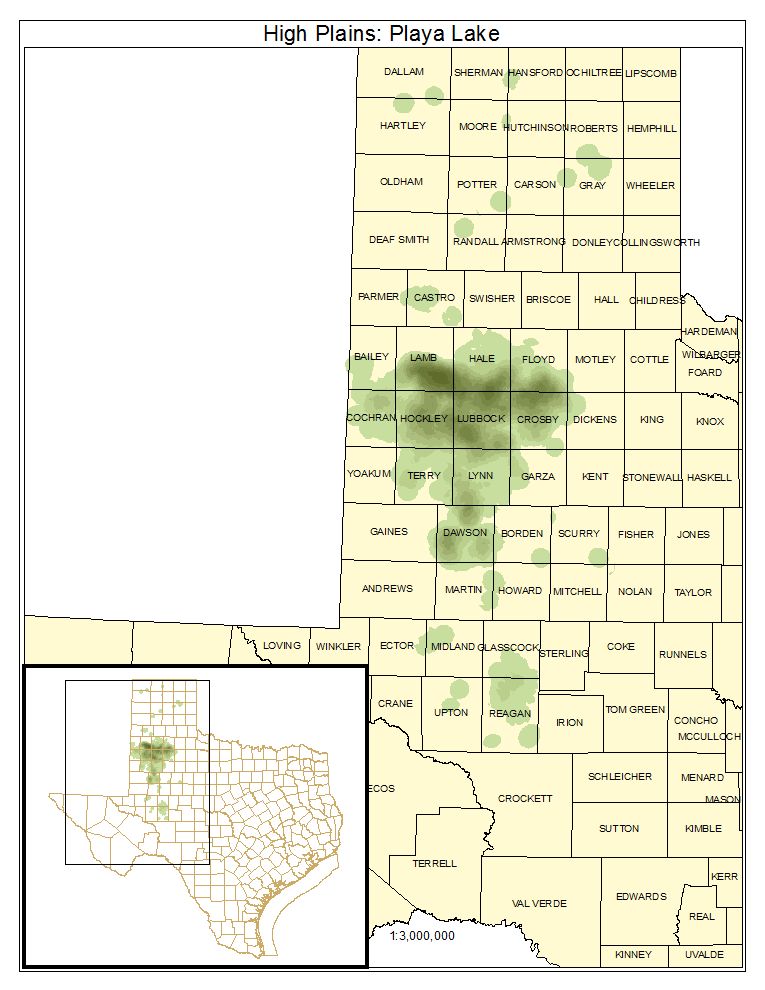
High Plains: Playa Lake
Areas in the vicinity of playa lakes that either lack significant vegetative cover or are covered by water.
Distribution Map

Public Land Occurrence
- None.
High Plains: Playa Grassland
Areas of the playa lake dominated by grassland species, typically occupying drier portions of the playa or playas that have not been inundated for extended periods.
Distribution Map

Photos

Public Land Occurrence
- None.
High Plains: Playa Marsh
Areas of the playas that have been inundated for sufficient time to be dominated by marsh species such as Sagittaria spp. (arrowheads), Typha spp. (cattails), Schoenoplectus spp. (bulrushes), Eleocharis spp. (spikerushes), and Polygonum spp. (smartweeds).
Distribution Map

Photos

Public Land Occurrence
- None.