Western Great Plains Saline Depression Wetland
Geology
Sometimes associated with the Tahoka Formation or the Ogallala Formation, but may occur over other substrates including Quaternary alluvium.
Landform
Somewhat circular basins, or sometimes forming linear bands adjacent to drainages.
Soils
High Lime, Salty Bottomland, and Wet Saline Ecological Sites.
Parent Description
Saline lakes and salty bottomlands often with salt encrusted surfaces and sometimes sparsely vegetated. Some of these lakes were thought to form from wind deflation and/or dissolution of subsurface strata and some have associated springs, with evaporation causing concentration of salts at the surface. Dominant species of the sites are often halophytic, or at least salt tolerant, including Sporobolus airoides (alkali sacaton), Distichlis spicata (saltgrass), Hordeum jubatum (foxtail barley), Sporobolus pyramidatus (whorled dropseed), Schoenoplectus spp. (bulrushes), Suaeda suffrutescens (desert seepweed), Allenrolfea occidentalis (pickle-weed), Salsola tragus (prickly Russian thistle), and Bassia scoparia (kochia). Woody species including Atriplex canescens (four-wing saltbush) and Prosopis glandulosa (honey mesquite) may also be present and sometimes develop significant cover. During periods of high rainfall and as one moves further from the salt encrusted surfaces into surrounding habitats, species composition becomes less dominated by halophytes with species such as Bothriochloa laguroides ssp. torreyana (silver bluestem), Sporobolus cryptandrus (sand dropseed), Aristida purpurea (purple threeawn), and Ziziphus obtusifolia (lotebush). Tamarix spp. (saltcedar) may be present to dominant.
Ecological Mapping Systems
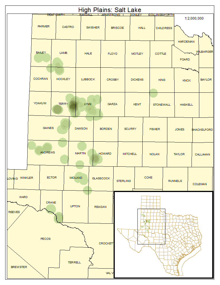
High Plains: Salt Lake
Margins and center of salt lakes, either sparsely vegetated or open water.
Distribution Map

Photos

Public Land Occurrence
- None.
High Plains: Salt Lake Shrubland
Shrublands surrounding salt lakes, often dominated by Atriplex canescens (four-wing saltbush) or Tamarix spp. (saltcedar). Prosopis glandulosa (honey mesquite) is also commonly encountered.
Distribution Map

Photos

Public Land Occurrence
- None.
High Plains: Alkali Sacaton Grassland
Grasslands surrounding salt lakes typically dominated by Sporobolus airoides (alkali sacaton), but with other species as mentioned in system description.
Distribution Map

Photos

Public Land Occurrence
- None.
High Plains: Salt Marsh
The wettest vegetated portion of the salt lake where marsh has developed with species such as Schoenoplectus spp. (bulrushes) abundant.
Distribution Map

Public Land Occurrence
- None.