Tamaulipan Lomas
Geology
Quaternary windblown deposits identified as clay dunes (Qcd).
Landform
Round, elliptic, or crescent-shaped topographic highs, often within a matrix of low flats influenced by wind-driven tides.
Soils
Often associated with the Coastal Ridge Ecological Site, such as Point Isabel clay loam and Lalinda fine sandy loam.
Parent Description
This system occupies clay dunes (lomas) along the lower Texas coast (and somewhat inland) and adjacent Mexico. These often develop from deposition of windblown fine sediments, resulting in elevated landforms within a matrix of tidal flats. These are typically fairly dense to extremely dense shrublands, often 2-4 meters in height, and dominated by species such as Ebenopsis ebano (Texas ebony), Citharexylum berlandieri (negrito), Leucophyllum frutescens (cenizo), Yucca treculeana (Spanish dagger), Jatropha dioica (leatherstem), Acacia rigidula (blackbrush), Opuntia engelmannii var. lindheimeri (Lindheimer prickly pear), Prosopis glandulosa (honey mesquite), Sideroxylon celastrinum (la coma), Forestiera angustifolia (desert olive), Celtis ehrenbergiana (granjeno), Guaiacum angustifolium (guayacan), Karwinskia humboldtiana (coyotillo), Castela erecta (amargosa), Zanthoxylum fagara (colima), Phaulothamnus spinescens (snake-eyes), and Ziziphus obtusifolia (lotebush). There may be scattered emergent trees of Ebenopsis ebano (Texas ebony) and Prosopis glandulosa (honey mesquite) forming a sparse woodland. Within these shrublands, the herbaceous layer is typically not well-developed, however the non-native Urochloa maxima (guineagrass), may be conspicuous. A grassland, often dominated by Sporobolus wrightii (big sacaton), occupies the margins of these clay dunes, as they grade downslope into the surrounding salty flats. These margins may also contain Sporobolus pyramidatus (whorled dropseed), Monanthochloe littoralis (shoregrass), and Spartina spartinae (Gulf cordgrass). Other somewhat halophytic species, such as Maytenus phyllanthoides (gutta-percha) and Prosopis reptans (tornillo) may also occupy these dunes. The proximity of many of these dunes to active tidal fluctuations and salt spray also influences species composition at these sites.
Ecological Mapping Systems
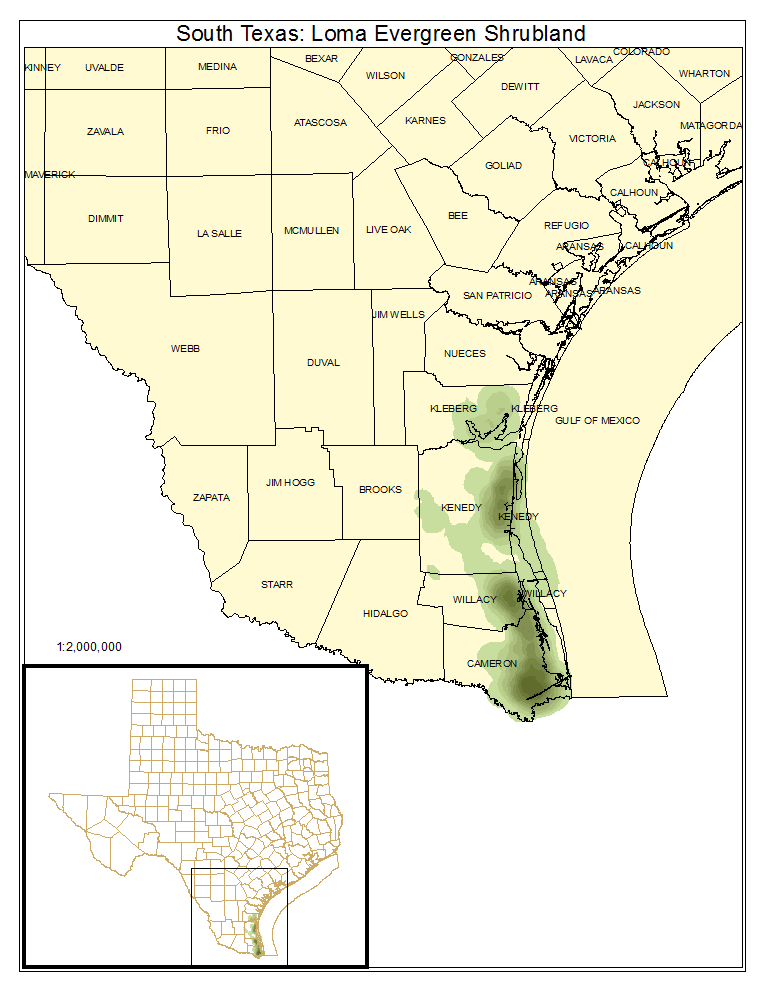
South Texas: Loma Evergreen Shrubland
Clay dunes where the shrub layer is dense and may contain a preponderance of evergreen shrubs such as Ebenopsis ebano (Texas ebony), Yucca treculeana (Spanish dagger), and Opuntia engelmannii var. lindheimeri (Lindheimer pricklypear). However, in this subtropical region, many species retain their leaves throughout the winter and only lose their leaves during drought.
Distribution Map

Photos

South Texas: Loma Deciduous Shrubland
Clay dunes where the shrub layer is less dense and has a reduced amount of evergreen components.
Distribution Map

Photos

South Texas: Loma Grassland
These grass dominated sites often occupy the edges of shrublands and are frequently dominated by Sporobolus wrightii (big sacaton), Spartina spartinae (Gulf cordgrass), Setaria leucopila (plains bristlegrass), Monanthochloe littoralis (shoregrass), and/or others. Urochloa maxima (guineagrass) may be a conspicuous non-native.
Distribution Map

Photos
