Tamaulipan Palm Grove Riparian Forest
Geology
Quaternary alluvium.
Landform
Currently on levees and resaca margins and adjacent lower sites near the current Rio Grande channel. Historically more widespread within the Rio Grande delta.
Soils
Loamy or Clayey Bottomland Ecological Sites.
Parent Description
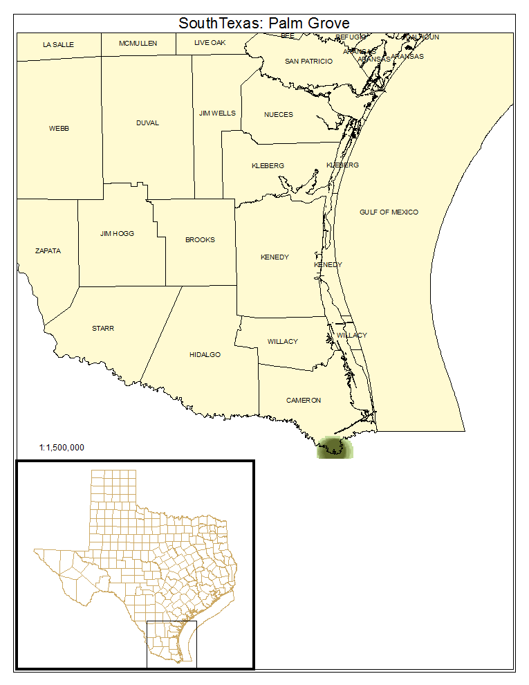
This system is currently limited to relatively small groves (typically less than 20 hectares) of Sabal mexicana (Mexican sabal palm, sometimes referred to as Sabal texana) located on loamy or clayey bottomland soils, such as those of the Rio Grande, Zalla, and Matamoros series, on the Rio Grande Delta and near the Rio Grande itself in Cameron County, Texas and similar sites in adjacent Mexico. These often occupy slight elevations along the margins of resacas or old river terraces, but may also occur on level sites. The system may have once occurred along the Rio Grande more than 120 km from its mouth, but is now limited to a few sites near the Gulf, with a few small stands identified in extreme southern Hidalgo County, Texas. These forests and woodlands often have a canopy dominated by Sabal mexicana (Mexican sabal palm), or may share dominance with other floodplain species such as Ebenopsis ebano (Texas ebony), Celtis laevigata (sugar hackberry), Leucaena pulverulenta (tepeguaje), Ulmus crassifolia (cedar elm), Ehretia anacua (anacua), and Fraxinus berlandieriana (Mexican ash). Prosopis glandulosa (honey mesquite), Sapindus saponaria var. drummondii (western soapberry), and Diospyros texana (Texas persimmon) are often present in the subcanopy. The canopy of these forests may reach a height of 15 m, and the subcanopy, to 10 m, may be composed of some of the species mentioned above. The shrub layer can be patchy with some areas extremely dense and containing species such as Zanthoxylum fagara (colima), Malpighia glabra (Barbados cherry), Celtis ehrenbergiana (granjeno), Erythrina herbacea (coralbean), Ziziphus obtusifolia (lotebush), Randia rhagocarpa (crucillo), Parkinsonia aculeate (retama), Havardia pallens (tenaza), Chiococca alba (David's milkberry), Iresine palmeri (Palmer's bloodleaf), and members of the canopy and subcanopy, and other areas relatively open. In some situations the ground may be covered with a layer of dead palm fronds, restricting the development of an herbaceous layer. In other areas, species including, but not limited to, Leersia monandra (bunch cutgrass), Salvia coccinea (tropical sage), Petiveria alliacea (hierba de las gallinitas), Rivina humilis (pigeonberry), Plumbago scandens (climbing plumbago), Tamaulipa azurea (blue boneset), Cocculus diversifolius (orientvine), and Malvaviscus arboreus (Turk's cap) may be present in the herbaceous layer. Fire may have been an important process in these forests as the sites may become extremely dry and a significant, if patchy, layer of palm thatch may be present. These forests appear to differ from other forests dominated by Sabal mexicana (Mexican sabal palm) further to the south. Ojeda and González Medrano (1977) describe a site of limited distribution in the northern part of the Sierra de San José de las Rusias in the Municipio of Soto La Marina in Tamaulipas, Mexico. It occurs at higher altitudes and on Oligocene geologic formations. Their brief description suggests that this is likely different in composition and process from the presently described system. Lopez and Dirzo (2007) describe a site further south in Vera Cruz, that also seems to differ relative to composition.
Ecological Mapping Systems
South Texas: Palm Grove
As described for system.
Distribution Map

Photos
