Western Great Plains Riparian
Geology
As defined, this type occurs along headwater streams and generally occurs over upland soils that have developed in place over a variety of bedrock types, often limestone in Phase 1.
Landform
This system occurs along drainages that may be intermittent and tend to be dominated by erosional processes (as opposed to depositional processes) within the drainage of the Clear Fork of the Middle Brazos River.
Soils
As this system is mapped, it by definition occurs outside of areas mapped as bottomland soils. Soils are therefore mapped with soils of the surrounding uplands.
Parent Description
Forests and woodlands may have species such Populus deltoides (eastern cottonwood), Salix nigra (black willow), Celtis laevigata var. reticulata (netleaf hackberry), and Sapindus saponaria var. drummondii (western soapberry). Juniperus ashei (Ashe juniper), Juniperus pinchotii (redberry juniper), or Quercus fusiformis (plateau live oak) may occur along the eastern edge of the range of this system where it grades into Edwards Plateau Riparian (CES303.652) or Southeastern Great Plains Riparian (CES206.709). Grasslands associated with riparian corridors may also be present and will generally be somewhat more mesic than grasslands of the surrounding landscape. Herbaceous species commonly encountered include Pleuraphis mutica (tobosa), Nassella leucotricha (Texas wintergrass), Bothriochloa laguroides ssp. torreyana (silver bluestem), and Schizachyrium scoparium (little bluestem). Marshes within these drainage corridors are mapped as Western Great Plains Open Freshwater Depression Wetland (CES303.675). Shrublands are typically strongly dominated by Prosopis glandulosa (honey mesquite) and are mapped as Western Great Plains Mesquite Woodland and Shrubland (CES303.668). The non-natives Tamarix spp. (saltcedars), Elaeagnus angustifolia (Russian olive), and Ulmus pumila (Siberian elm) may also be commonly encountered in this system.
Ecological Mapping Systems
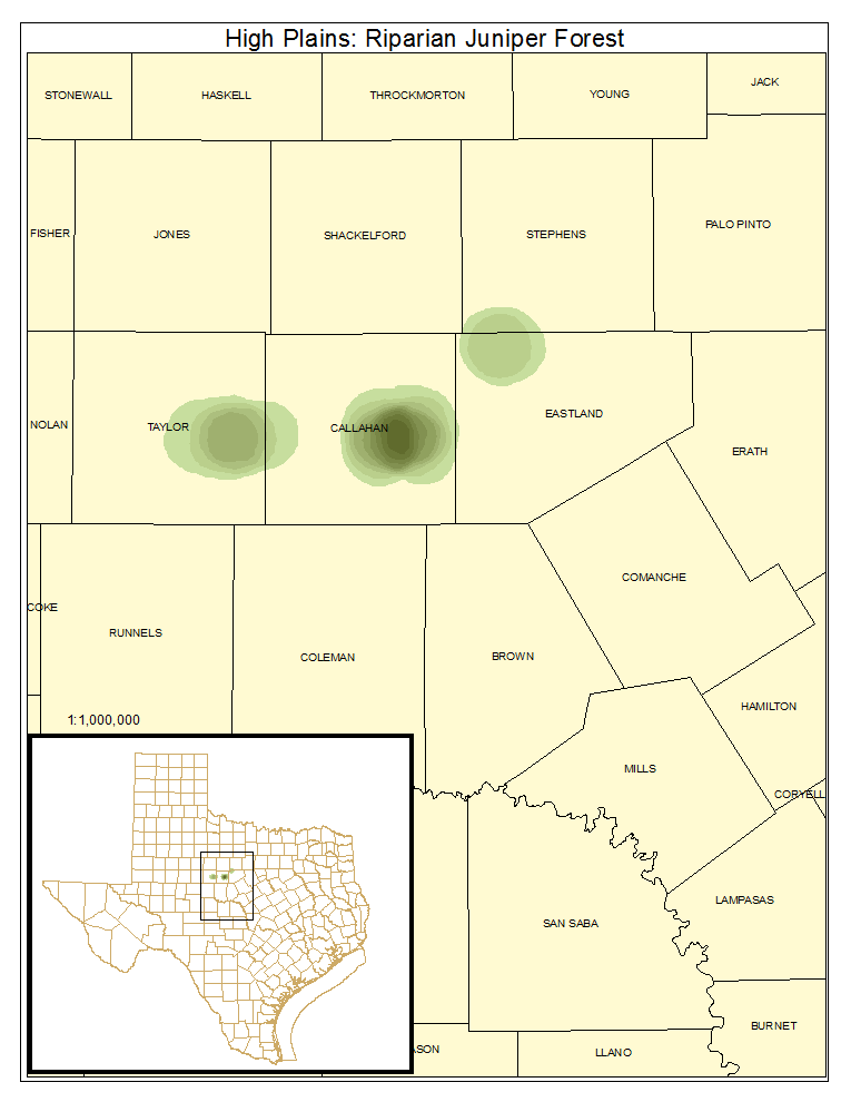
High Plains: Riparian Juniper Forest
Forest or woodland as described for the system, but with Juniperus ashei (Ashe juniper) or, less commonly in Phase 1, Juniperus pinchotii (redberry juniper) as the overstory dominant.
Distribution Map

Photos

Public Land Occurrence
- None.
High Plains: Riparian Live Oak Forest
Woodland or forest of riparian situations with Quercus fusiformis (plateau live oak) dominating the canopy. This is a minor component of the system. Live oak occurs in this system only in the southeastern portion of its range, where Quercus fusiformis (plateau live oak) is at the western edge of its range.
Distribution Map

Photos

Public Land Occurrence
- None.
High Plains: Riparian Hardwood / Juniper Forest
Forest or woodland as described for the system, with the canopy containing significant amounts of Juniperus ashei (Ashe juniper) or Juniperus pinchotii (redberry juniper) in addition to the deciduous components. This is a minor component of the system in Phase 1.
Distribution Map

Photos

Public Land Occurrence
- None.
High Plains: Riparian Hardwood Forest
Forest and woodland as described for the system with a canopy dominated by deciduous species.
Distribution Map

Photos

High Plains: Riparian Juniper Shrubland
Shrubland of riparian situations dominated by Juniperus ashei (Ashe juniper) or Juniperus pinchotii (redberry juniper).
Distribution Map

Photos

Public Land Occurrence
- None.
High Plains: Riparian Deciduous Shrubland
Shrubland of riparian situations dominated by deciduous shrub species, primarily Prosopis glandulosa (mesquite). This is the primary vegetation type mapped as this system.
Distribution Map

Photos

Public Land Occurrence
- None.
High Plains: Riparian Herbaceous Vegetation
Grassland or marsh of riparian situations as described for the system.
Distribution Map

Photos

Public Land Occurrence
- Abilene State Park Area: Texas Parks & Wildlife Department
- Copper Breaks State Park: Texas Parks & Wildlife Department
- Fort Griffin State Historic Site: Texas Historical Commission
- Lake Colorado City State Park: Texas Parks & Wildlife Department
- Matador Wildlife Management Area: Texas Parks & Wildlife Department
High Plains: Riparian Emergent Marsh
Marsh of riparian situations. These marshes may also be mapped as Western Great Plains Open Freshwater Depression Wetland (CES303.675).
Distribution Map

Public Land Occurrence
- None.