Use the Trails Maps Anytime, Anywhere!
Download Texas State Parks' comprehensive trails map to your phone. The trails data file covers all state parks and works with any GIS-compatible app to plan your hikes or to see where you are on the trail. This one-time download will put a map for every trail, in every park, right in the palm of your hand.
How to Use State Parks Trails Data
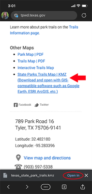
- Download and save the Texas State Parks Trails Data KMZ file – this file contains information for all trails, in all Texas State Parks. Find the link to download on the “Maps” page for any park.

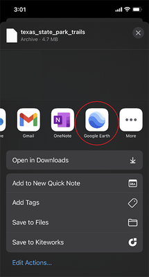
- Open the trails data file using a GIS-compatible software such as Google Earth, ESRI ArcGIS, etc. on your mobile device (or computer).

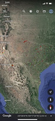
- Zoom in on the park you are visiting and see exactly where you are on the trails.


Please note: The trails data file is updated periodically, so be sure to check back for the latest version.
