Conservation Committee
Wednesday, August 24, 2011
9:00 a.m.
Texas Parks and Wildlife Department
Commission Hearing Room
4200 Smith School Road, Austin, TX 78744
Commissioner Peter M. Holt, Committee Chair
Scott Boruff, Committee Liaison
Approval of Previous Meeting Minutes
- Update on TPWD Progress in Implementing the TPWD Land and Water Resources Conservation and Recreation Plan
Staff: Carter Smith - Edwards Aquifer Authority Recovery Implementation Plan (RIP) and Designation of State Scientific Area
Staff: Cindy Loeffler, Colette Barron Bradsby - Land Acquisition – Yoakum County – 320 Acres at the Yoakum Dunes Conservation Area (Action Item No. 19)
Staff: Corky Kuhlmann Request for Access Easement – Aransas County – Commercial Driveway at Goose Island State Park – Request Permission to begin the Public Notice and Input Process(WITHDRAWN)- Donation of Land – Orange County – Approximately 218 Acres at Tony Houseman Wildlife Management Area – Request Permission to begin the Public Notice and Input Process
Staff: Ted Hollingsworth - Request for Easement – Ward and Winkler Counties – Water Distribution Pipeline Easement at Monahans Sandhills State Park – Request Permission to begin the Public Notice and Input Process
Staff: Ted Hollingsworth - Transfer of State Historic Site – Guadalupe County — Sebastopol House State Historic Site to the City of Seguin (Action Item No. 3)
Staff: Ted Hollingsworth - Land Acquisition – Presidio County – Approximately 520 Acres at Big Bend Ranch State Park (Action Item No. 20)
Staff: Ted Hollingsworth Proposed Land Sale – Randall and Armstrong Counties– (WITHDRAWN)- New Park Acquisition – Palo Pinto and Stephens Counties (Executive Session)
(Action Item No. 21)
Staff: Ted Hollingsworth - Cameron County Land Issues (Executive Session)
Staff: Scott Boruff
Committee Agenda Item No. 1
Presenter: Carter Smith
Conservation Committee
Update on TPWD Progress in Implementing the
TPWD Land and Water Resources Conservation and Recreation Plan
August 24, 2011
I. Executive Summary: Executive Director Carter Smith will briefly update the Commission on the status of the agency’s efforts to implement the Land and Water Resources Conservation and Recreation Plan (the “Plan”).
II. Discussion: In 2001, the 77th Texas Legislature directed that the Texas Parks and Wildlife Department (TPWD) develop a Land and Water Resources Conservation and Recreation Plan (Tex. Park & Wild. Code §11.104). In 2002, the Texas Parks and Wildlife Commission (the Commission) adopted the first Plan. A revised Plan was adopted by the Commission in January 2005. In November 2009, the Commission approved a new Plan effective January 1, 2010. The 2010 Plan is available on the TPWD web site. Executive Director Carter Smith will update the Conservation Committee on TPWD’s recent progress in achieving the Plan’s goals, objectives and deliverables as they relate to the Conservation Committee.
The Plan consists of the following four goals:
- Practice, Encourage and Enable Science-based Stewardship of Natural and Cultural Resources
- Increase Access To and Participation In the Outdoors
- Educate, Inform and Engage Texas Citizens in Support of Conservation and Recreation
- Employ Efficient, Sustainable and Sound Business Practices
Committee Agenda Item No. 2
Presenters: Cindy Loeffler
Colette Barron Bradsby
Conservation Committee
Edwards Aquifer Recovery Implementation Program (EARIP) and
Designation of a State Scientific Area
August 24, 2011
I. Executive Summary: The Edwards Aquifer Recovery Implementation Program (EARIP) is an open, voluntary, collaborative, consensus-based stakeholder process with a goal to help recover federally listed threatened and endangered species that depend on the Edwards Aquifer. The EARIP was initiated by the USFWS in 2006, and modified in 2007 to meet Senate Bill 3 State of Texas requirements. TPWD participation in the EARIP is extensive with participation from the Legal Division, Coastal Fisheries Division, Inland Fisheries Division and the Wildlife Division. The final product of the EARIP will be a plan to protect the federally listed endangered or threatened species while managing the use of the Edwards Aquifer. For the past four years the EARIP has been working to reach consensus on a set of strategies for protecting spring flows, especially during extreme drought periods. This plan is to be completed by September 1, 2012.
II. Discussion: The set of strategies for protecting spring flows has been coined the “Bottom Up” approach because it sets forth an incremental, phased approach to reduce aquifer pumping, increase ecosystem restoration measures and to monitor progress of these actions. Key measures included in the “Bottom Up” approach for reducing aquifer pumping include increased conservation by smaller communities, an innovation called Aquifer Storage and Recovery (ASR), voluntary suspension of irrigation pumping during drought and additional mandatory Critical Period pumping restrictions. Ecosystem restoration measures include habitat restoration, exotic species management and recreation management.
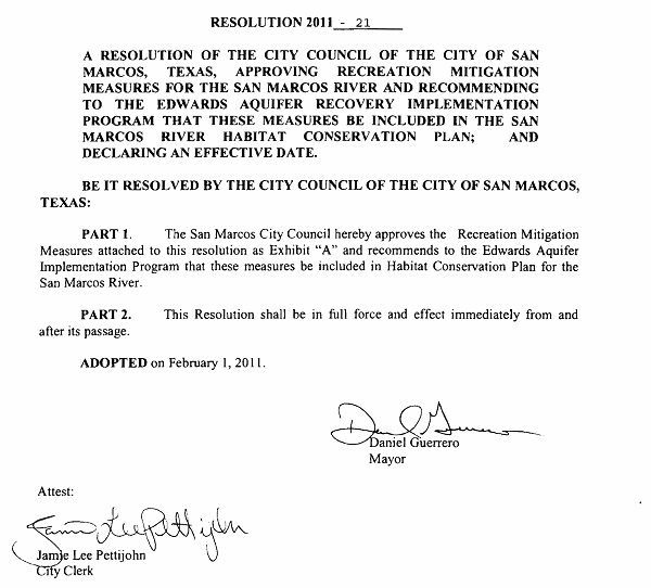
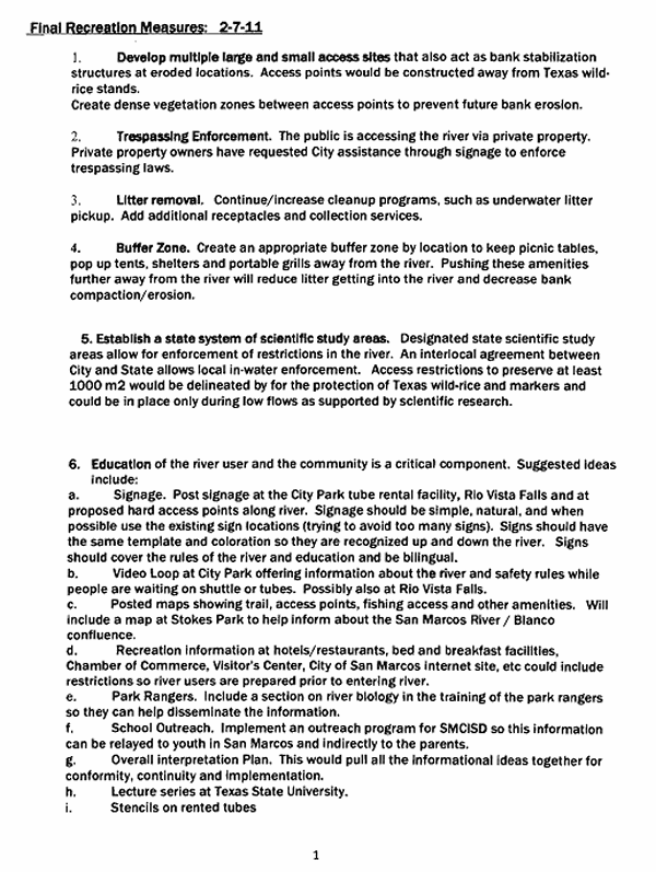
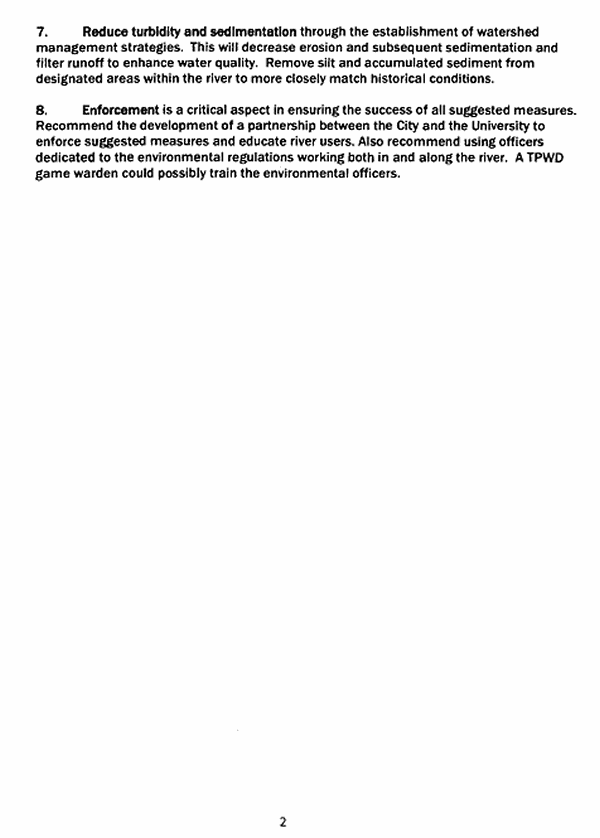
Designation of a State Scientific Area in the San Marcos River is one option discussed for addressing recreational impacts to Texas wild-rice, a federally-endangered plant which is found only in the San Marcos River. The San Marcos River is also a popular recreation destination, requiring a species-protection approach that addresses recreation as well. The San Marcos City Council adopted a resolution on February 1, 2011 approving a number of “recreation mitigation measures” for inclusion in the EARIP Habitat Conservation Plan. Establishment of a “state system of scientific study areas” was included among the measures. The Texas State University President’s Cabinet has also approved the “Bottom Up” package, including recreation mitigation measures.
There are still many unknowns, primarily because the severity of future droughts and associated ecosystem impacts cannot be predicted. To help address this uncertainty the incremental, phased approach allows for adaptive management and the ability to adjust protection measures in the future. The “Bottom Up” approach also includes provisions for enhancing the ability to protect species in refugia if a drought worse than predicted does occur.
Committee Agenda Item No. 2
Exhibit A
Committee Agenda Item No. 5
Presenter: Ted Hollingsworth
Conservation Committee
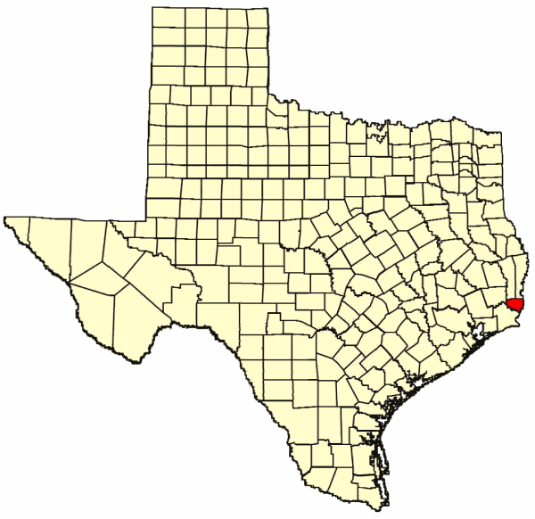
Donation of Land – Orange County
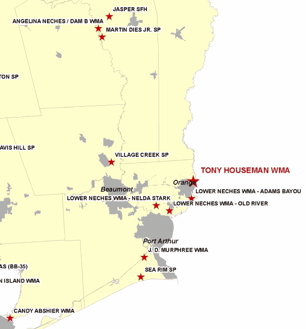
218± Acres at Tony Houseman Wildlife Management Area
August 24, 2011
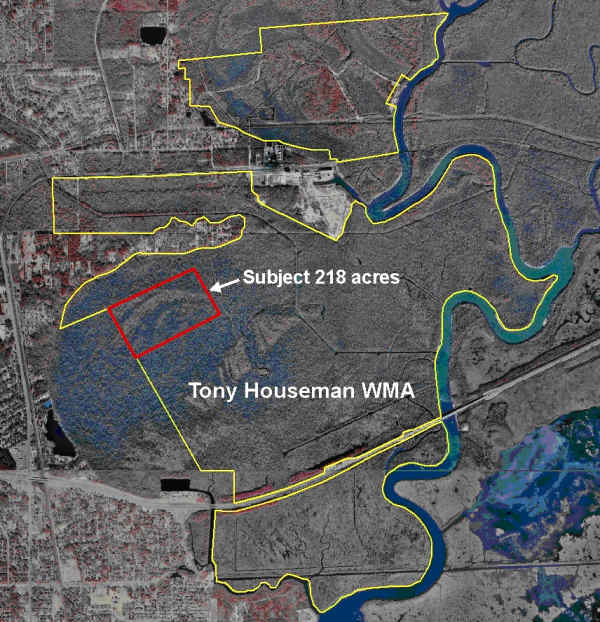
I. Executive Summary: 218± acres of quality bottomland habitat have been offered to Texas Parks and Wildlife Department for addition to the Tony Houseman WMA by The Conservation Fund, to satisfy compensatory wetland mitigation needs for a third party.
II. Discussion: Texas Parks and Wildlife Department and Air Products LLC, have negotiated an easement for an 18” hydrogen pipeline to cross the Tony Houseman Wildlife Management Area (WMA), pursuant to a Commission Resolution signed in May 2011. As part of the assessment and compensation for impacts of the pipeline route in Texas, Air Products partnered with The Conservation Fund (TCF) to identify and acquire high-quality bottomland hardwood forest tracts adjacent to the WMA that could serve to offset both fish and wildlife impacts to the WMA and impacts to waters of the U.S. (wetlands) under the jurisdiction of the U.S. Army Corps of Engineers.
To satisfy compensatory requirements for impacts to waters of the U.S., Air Products has paid TCF for the acquisition of two tracts adjacent to the WMA totaling 218± acres. In compliance with their federal mitigation plan and arrangements made with staff of TPWD, TCF now offers those tracts to TPWD for addition to the WMA.
Staff requests permission to begin the public notice and input process.
Committee Agenda Item No. 5
Exhibit A
Location Map for Tony Houseman WMA in Orange County
Committee Agenda Item No. 5
Exhibit B
Vicinity Map for Tony Houseman WMA East of Orange, Texas
Committee Agenda Item No. 5
Exhibit C
Site Map for Subject Donation Tracts at Tony Houseman WMA
Committee Agenda Item No. 6
Presenter: Ted Hollingsworth
Conservation Committee
Request for Easement – Ward and Winkler Counties
Water Distribution Pipeline Easement at Monahans Sandhills State Park
August 24, 2011
I. Executive Summary: The Colorado River Municipal Water District requests an easement for the installation of a 48” water distribution line across Monahans Sandhills State Park in Ward and Winkler Counties.
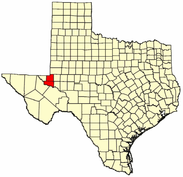
II. Discussion: Monahans Sandhills State Park (SP) covers 3,840 acres straddling Ward and Winkler counties southwest of Odessa. As the name implies, the park preserves an excellent example of arid land sand dunes, some up to 70 feet high. The site protects a range of resources such as important archeological sites and the dunes sagebrush lizard, a candidate species for federal listing as an endangered species, and the Havard shin oak woodlands.
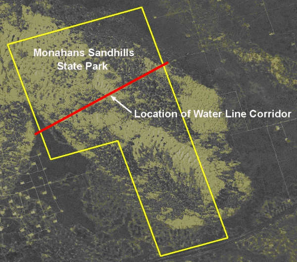
The park has been managed and operated by TPWD since 1956 under a long-term lease from the Sealy and Smith Foundation of Galveston. In 1971 the Colorado River Municipal Water District (CRMWD) obtained an easement from the Foundation and installed a 33” water line through the SP in Ward County. The CRMWD supplies water to Odessa, Snyder and Big Spring. Due to growth in these communities since 1971, and the strain on water supplies precipitated by the current drought, CRMWD wishes to install a second pipeline of 48” parallel to the existing line. They would like to begin construction in January 2012.
The Foundation has requested that TPWD negotiate terms and conditions, including mitigation and compensation for damages to natural and cultural resources, for the segment of the line passing through the SP. Staff requests permission to begin the public notice and input process.
Committee Agenda Item No. 6
Exhibit A
Location Map for Monahans Sandhills SP in Ward and Winkler Counties
Committee Agenda Item No. 6
Exhibit B
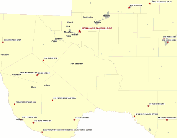
Vicinity Map for Monahans Sandhills SP 30 miles Southwest of Odessa
Committee Agenda Item No. 6
Exhibit C
Site Map for Requested Easement at Monahans Sandhills SP
Committee Agenda Item No. 10
Presenter: Ted Hollingsworth
Conservation Committee
New Park Acquisition – Palo Pinto County
August 24, 2011
I. Executive Summary: Staff has identified a site in Palo Pinto and Eastland Counties deemed suitable as the site of a new state park.
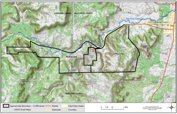
II. Discussion: In 2008, Texas Parks and Wildlife Department (TPWD) netted $9.2 million from the sale of the Eagle Mountain Lake State Park property, with the understanding these funds would be used to acquire a site for a new state park in the Fort Worth area. TPWD subsequently entered into a Letter of Intent with The Nature Conservancy (TNC) to provide potential site identification and landowner negotiation services. Since that time, staff has evaluated a number of potential new park locations, primarily in Palo Pinto, Parker, Tarrant and Johnson counties.
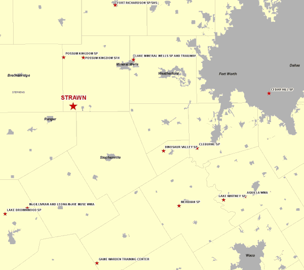
A potential park site consisting of three contiguous tracts totaling 3300± acres just outside Strawn, 70 miles southwest of Fort Worth, has been explored and investigated, and appears to be a very suitable candidate for a new state park. The site possesses extraordinary conservation and recreation potential. TNC has entered into options-to-buy for all three tracts. With concurrence from the Legislative Budget Board, TPWD staff and TNC proceeded with surveys, appraisals and Phase I assessments necessary to position TPWD for closing and acquisition of these tracts within the timeframe of the options.
Staff requests permission to begin the public notice and input process for this acquisition.
Committee Agenda Item No. 10
Exhibit A
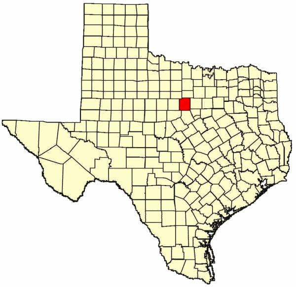
Map Showing Location of Proposed Park Site in Palo Pinto County
Committee Agenda Item No. 10
Exhibit B
Vicinity Map for Proposed Park 70 Miles Southwest of Fort Worth
Committee Agenda Item No. 10
Exhibit C
Tract Map of Proposed New State Park Site
