
Fishing
- Possession and Transport of Exotic Aquatic Species
- Licenses & Regulations
- ShareLunkers
- Fish Identification
- Fish Consumption
- Texas Freshwater Fisheries Center
Water Resources
- Texas Reservoir Levels
- US Army Corps of Engineers
- Texas Water Issues
- Golden Alga
- Aquatic Vegetation
3802 East End Blvd. South
Marshall, Texas 75672
(903) 938-1007
Tim Bister, Biologist
Local Information
- Mount
Pleasant Chamber of Commerce
1604 N. Jefferson
PO Box 1237
Mount Pleasant, Texas 75456-1237
(903) 572-8567
Nearby State Parks
Lake Monticello
Quick Links: Fishing Regulations | Angling Opportunities | Cover & Structure | Tips & Tactics
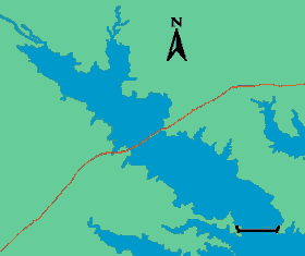
Lake Characteristics
Location: In Titus County on Blundell and
Smith Creeks in the Cypress River Basin, approximately 10 miles
southwest of Mount Pleasant
Surface area: 2,001 acres
Maximum depth: 40 feet
Impounded: 1972
Water Conditions
Current Lake Level
Conservation Pool Elevation: 340 ft. msl
Fluctuation: Average 2-3 feet
annually
Normal Clarity: Moderately clear
Reservoir Controlling Authority
TXU
1601 Bryan Street
Dallas, Texas 75201
(214) 812-8699
Aquatic Vegetation
Coverage is approximately 10% of the lake's total surface area. The dominant species is hydrilla.
Predominant Fish Species
Lake Records
Current
Fishing Report
Stocking History
Latest Survey Report
Lake Maps
Commercial maps may be available.
Fishing Regulations
This reservoir has special regulations on some fishes. See bag and size limits for this lake.
Angling Opportunities
Lake Monticello is one of the most popular largemouth bass fisheries in Texas. On September 1, 1998, the slot length limit was changed from 14-21 inches to 14-24 inches in an effort to protect larger fish and possibly increase trophy fishing opportunities. Channel catfish are also popular at Lake Monticello. The species is abundant with high numbers of legal-size fish available for harvest. Anglers who fish for channel cats catch 1 to 2.5 fish per hour.
| Species | Poor | Fair | Good | Excellent |
|---|---|---|---|---|
| Largemouth Bass | ||||
| Catfish | ||||
| Sunfish |
Fishing Cover/Structure
Structural habitat is comprised of inundated timber, brush, and creek channels. Aquatic vegetation also provides cover.