Edwards Plateau Upland Depression
Geology
Massive Cretaceous limestones, such as Edwards Limestone.
Landform
Internally draining depressions of karstic origin on level plateau surfaces.
Soils
Loams and clay loams, often mapped as Lakebed ecoclass.
Parent Description
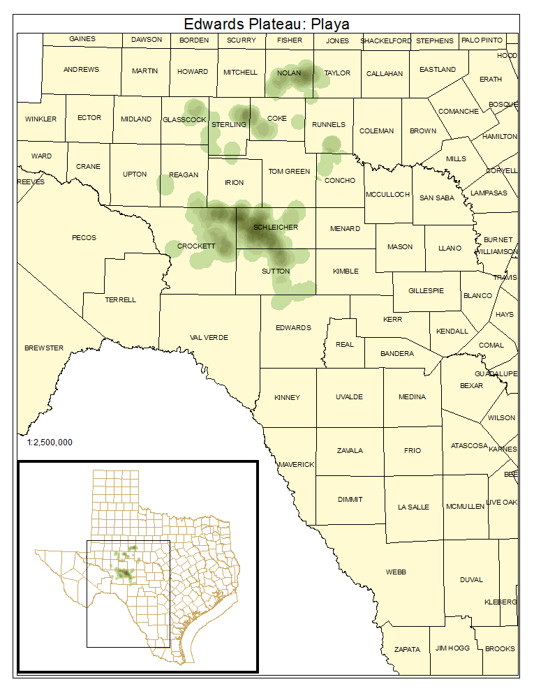
This system includes shallow wetlands formed over limestone on the Edwards Plateau of Texas. Variable in size and duration of inundation, these wetlands are typically found on level uplands. Dominant vegetation includes both graminoids and forbs tolerant of wet periods but not necessarily wetland-dependent. Dominant species may include Pleuraphis mutica (tobosa), Bouteloua dactyloides (buffalograss), Tridens albescens (white tridens), Sedum pulchellum (widowscross), Sedum nuttallianum (yellow stonecrop), Sporobolus vaginiflorus (poverty dropseed), Chaetopappa bellidifolia (hairy leastdaisy), Ambrosia psilostachya (western ragweed), Paronychia spp. (whitlow-wort), and the alga Nostoc commune (blue-green algae). Panicum obtusum (vine-mesquite), Bothriochloa barbinodis (cane bluestem), Pascopyrum smithii (western wheatgrass), Bouteloua gracilis (blue grama), Chenopodium album (lambsquarters), Helianthus ciliaris (blue-weed), and Solanum elaeagnifolium (silverleaf nightshade) may also be present. Some larger occurrences of this wetland system are found in Crockett, Reagan, Schleicher, Irion and Sterling counties in the northwest Edwards Plateau (the Eldorado Plateau). In Phase I, they are found primarily in Runnels, Concho, and Sutton counties. Formation of these occurrences is apparently from solution of the underlying limestone.
Ecological Mapping Systems
Edwards Plateau: Playa
As described for system.
Distribution Map

Photos

Public Land Occurrence
- None.