Conservation Committee
Wednesday, 9:00 a.m.
March 30, 2011
Texas Parks and Wildlife Department
Commission Hearing Room
4200 Smith School Road, Austin, TX 78744
Commissioner Peter M. Holt
Scott Boruff, Committee Liaison
Approval of Previous Meeting Minutes
- Update on TPWD Progress in Implementing the TPWD Land and Water Resources Conservation and Recreation Plan
- Park Road 4 – National Register of Historic Places
- Crab Trap Clean-up
- Resaca de la Palma Habitat Restoration
- Panhandle Wildfires
- Request for Pipeline Easement – Orange County – Tony Houseman Wildlife Management Area – Request Permission to Begin the Public Notice and Input Process
Staff: Ted Hollingsworth - Request for Utility Easement – Harris County – Telecommunication Cable at San Jacinto Battleground State Historic Site – Request Permission to Begin the Public Notice and Input Process
Staff: Ted Hollingsworth - Disposition of Land – Parker County – Sale of 8.5 ± Acres at Lake Mineral Wells State Trailway – Request Permission to Begin the Public Notice and Input Process
Staff: Ted Hollingsworth - Land Acquisition – Smith County – Half-acre at Tyler State Park – Request Permission to Begin the Public Notice and Input Process
Staff: Corky Kuhlmann - Acceptance of Land Donation – Galveston County – Approximately 50 Acres at Galveston Island State Park – Request Permission to Begin the Public Notice and Input Process
Staff: Corky Kuhlmann - New Park Search Briefing – Palo Pinto County (Executive Session)
Staff: Ted Hollingsworth
Committee Agenda Item No. 1
Presenter: Carter Smith
Conservation Committee
Update on TPWD Progress in Implementing the
TPWD Land and Water Resources Conservation and Recreation Plan
March 30, 2011
I. Executive Summary: Executive Director Carter Smith will briefly update the Commission on the status of the agency’s efforts to implement the Land and Water Resources Conservation and Recreation Plan (the “Plan”).
II. Discussion: In 2001, the 77th Texas Legislature directed that the Texas Parks and Wildlife Department (TPWD) develop a Land and Water Resources Conservation and Recreation Plan (Tex. Park & Wild. Code §11.104). In 2002, the Texas Parks and Wildlife Commission (the Commission) adopted the first Plan. A revised Plan was adopted by the Commission in January 2005. In November 2009, the Commission approved a new Plan effective January 1, 2010. The 2010 Plan is available on the TPWD web site. Executive Director Carter Smith will update the Conservation Committee on TPWD’s recent progress in achieving the Plan’s goals, objectives and deliverables as they relate to the Conservation Committee.
The Plan consists of the following four goals:
- Practice, Encourage and Enable Science-based Stewardship of Natural and Cultural Resources
- Increase Access To and Participation In the Outdoors
- Educate, Inform and Engage Texas Citizens in Support of Conservation and Recreation
- Employ Efficient, Sustainable and Sound Business Practices
Committee Agenda Item No. 2
Presenter: Ted Hollingsworth
Conservation Committee
Request for Pipeline Easement – Orange County
Tony Houseman Wildlife Management Area
March 30, 2011
I. Executive Summary: Air Products LLC, requests an easement from Texas Parks and Wildlife Department (TPWD) for the installation of an 18” hydrogen pipeline across the Tony Houseman Wildlife Management Area.
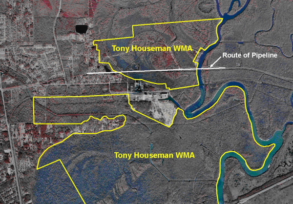
II. Discussion: Most of the 3987-acre Tony Houseman Wildlife Management Area (WMA) was acquired in 1998 and is managed for wetland credit used by the Texas Department of Transportation (TxDOT) as mitigation for impacts associated with road development projects in southeast Texas. Air Products, LLC, wishes to install an 18” diameter hydrogen pipeline across the WMA by means of a series of horizontal directional drills with final pipeline alignment within an existing pipeline right-of-way (ROW). Impacts will consist of pipeline insertion and extraction points and equipment staging areas. All are considered temporary and restorable.
Per the precedent established by granting a similar easement to Denbury Green Pipeline, LLC in 2008, Air Products LLC is working with the Conservation Fund to identify and acquire lands that could be added to the WMA as partial compensation for damages. Staff requests permission to begin the public notice and input process.
Attachments — 3
Committee Agenda Item No. 2
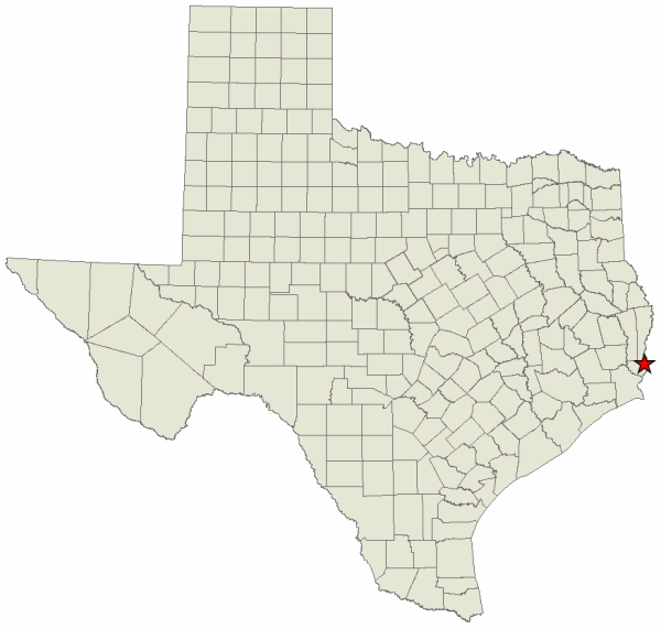
Exhibit A
Location Map for Tony Houseman WMA in Orange County
Committee Agenda Item No. 2
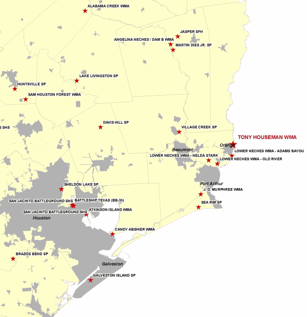
Exhibit B
Vicinity Map for Tony Houseman WMA North of Orange
Committee Agenda Item No. 2
Exhibit C
Site Map for the Tony Houseman WMA Proposed Pipeline
Committee Agenda Item No. 3
Presenter: Ted Hollingsworth
Conservation Committee
Request for Utility Easement – Harris County
Telecommunications Cable at San Jacinto Battleground State Historic Site
March 30, 2011
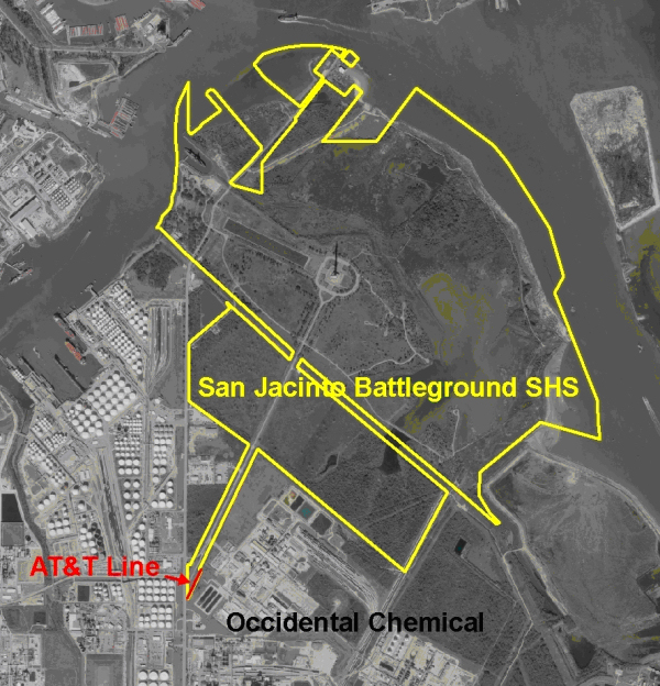
I. Executive Summary: AT&T requests an after-the-fact easement for a telecommunications cable installed across a portion of the San Jacinto Battleground State Historic Site (SHS) in January 2011.
II. Discussion: In January 2011, AT&T excavated two (2) small bore pits in the extreme southern end of the San Jacinto Battleground State Historic Site (SHS), as part of a project to provide upgraded telecommunications facilities to Occidental Chemical Company. AT&T was unaware they were excavating on SHS land. Park staff halted the work, and AT&T agreed to conduct all necessary archeological testing and await a permit from TPWD before proceeding. The telecommunications line itself is to be directionally drilled.
A temporary construction permit has been issued to AT&T, subject to authorization of an easement by the TPW Commission. Staff requests permission to begin the public notice and input process.
Attachments — 4
Committee Agenda Item No. 3
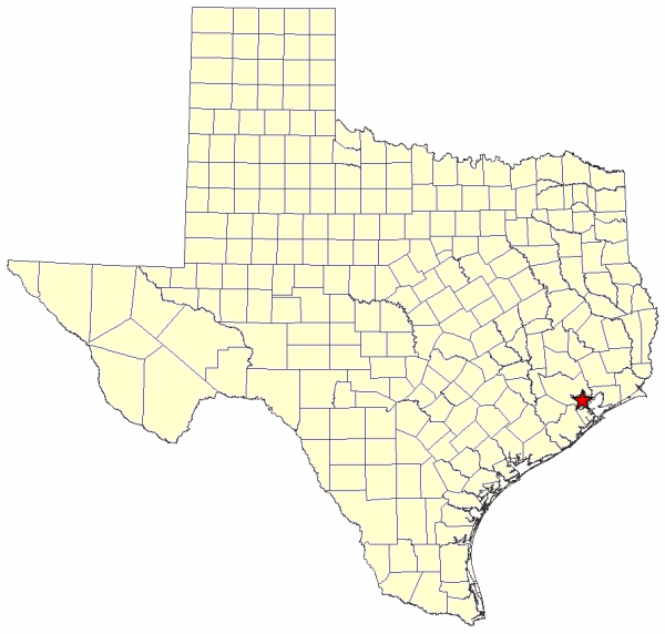
Exhibit A
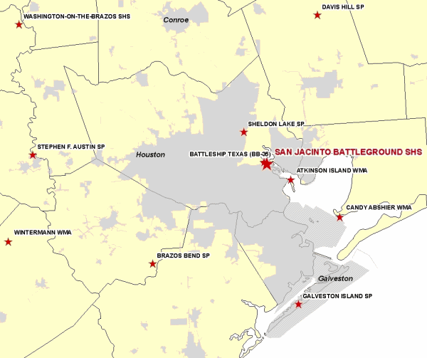
Location Map for San Jacinto Battleground SHS in Harris County
Committee Agenda Item No. 3
Exhibit B
Vicinity Map for the San Jacinto Battleground SHS 30 Miles East of Houston
Committee Agenda Item No. 3
Exhibit C
Map of SHS Showing Location of AT&T Communications Cable
Committee Agenda Item No. 3
Exhibit D
Site Map Showing Location of AT&T Communications Cable

Committee Agenda Item No. 4
Presenter: Ted Hollingsworth
Conservation Committee
Disposition of Land – Parker County
8.5± Acres at Lake Mineral Wells State Trailway
March 30, 2011
I. Executive Summary: Union Pacific Railroad wishes to exercise its contractual authority to buy back a portion of the Lake Mineral Wells State Trailway for development for railroad operations.
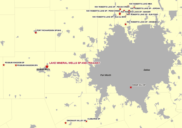
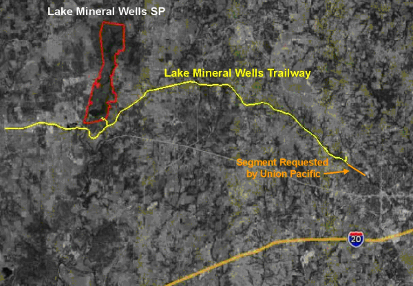
II. Discussion: The Lake Mineral Wells State Trailway is a former right-of-way for the Missouri Pacific Railroad, acquired in 1996, for the purpose of creating a 20-mile hike/bike/equestrian corridor connecting Weatherford in Palo Pinto County and Mineral Wells in Parker County. The deed which transferred the land to TPWD included the provision that the railroad company or its assigns could buy back any portion of the trailway at any time for railroad purposes, by paying the Department appraised value plus the cost of any improvements which had been made.
Union Pacific Railroad would like to exercise this provision in the deed and buy back a segment of the trailway near Mineral Wells 3324’ in length. This portion of the railway has not been improved for public use, still sporting the ties and rails last used in the early 1990’s. Staff requests permission begin the public notice and input process on this disposition.
Attachments — 3
Committee Agenda Item No. 4
Exhibit A
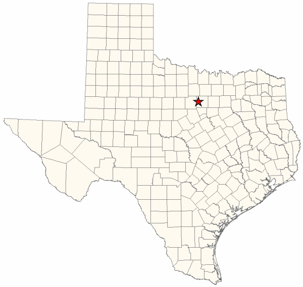
Location Map for Lake Mineral Wells Trailway in Parker County
Committee Agenda Item No. 4
Exhibit B
Vicinity Lake Mineral Wells Trailway Weatherford to Mineral Wells
Committee Agenda Item No. 4
Exhibit C
Site Map Showing Segment Requested by Union Pacific
Committee Agenda Item No. 5
Presenter: Corky Kuhlmann
Conservation Committee
Land Acquisition – Smith County
Tyler State Park
March 30, 2011
I. Executive Summary: Texas Parks and Wildlife Department (TPWD) is in negotiations with a private landowner for the acquisition of a half-acre tract as an addition to Tyler State Park.
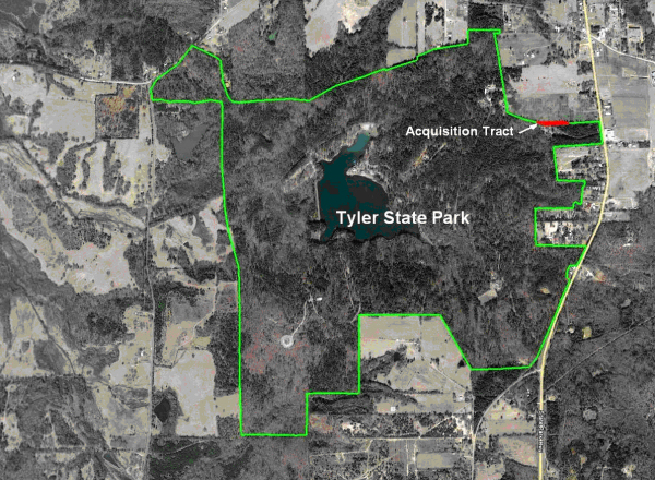
II. Discussion: TPWD staff is currently in negotiations with a private landowner for the acquisition of an approximate half-acre tract of land (Tract) adjacent to the northeast boundary of Tyler State Park (Park) having 700’ of common boundary with the Park.
The Tract is located north of the Park headquarters and is a long narrow strip that is parallel to the Park entrance road and would act as a buffer between private land and a future headquarters parking lot.
Staff would like to begin the process of providing public notice and obtaining public input regarding a proposed acquisition of an approximate half-acre acre tract as an addition to Tyler State Park.
Attachments — 3
Committee Agenda Item No. 5
Exhibit A
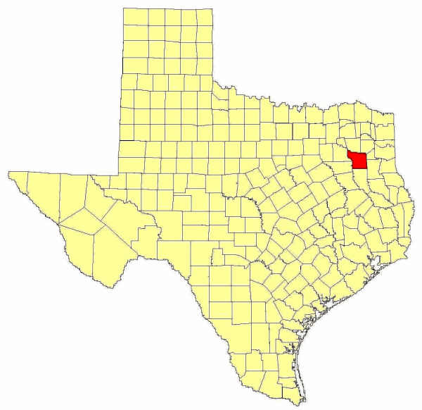
Location Map
Smith County
Committee Agenda Item No. 5
Exhibit B
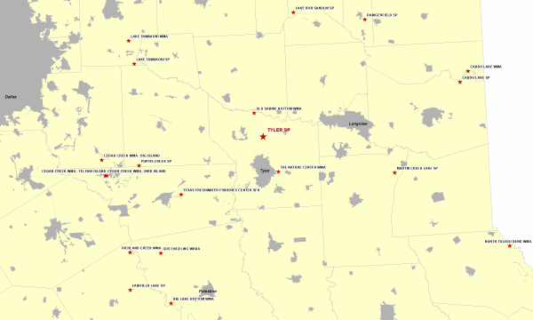
Vicinity Map
Tyler State Park
Committee Agenda Item No. 5
Exhibit C
Site Map
Tyler State Park
Committee Agenda Item No. 6
Presenter: Corky Kuhlmann
Conservation Committee
Land Donation – Galveston County
Galveston Island State Park
March 30, 2011
I. Executive Summary: Texas Parks and Wildlife Department (TPWD) has been offered a donation of approximately 50-acres of land in Galveston County.
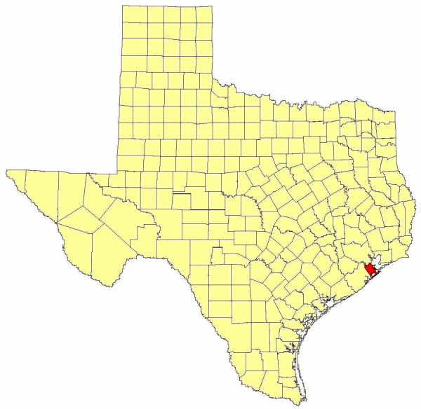
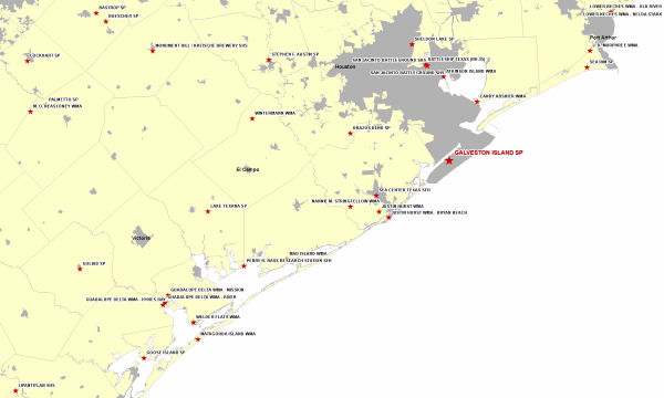
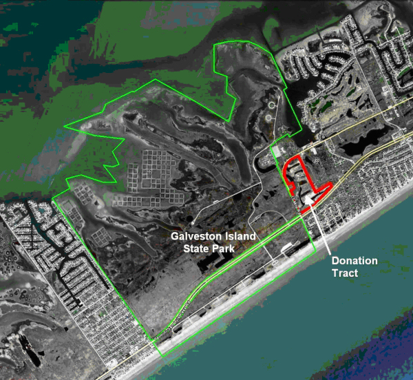
II. Discussion: TPWD has been offered a donation of an approximate 50-acre tract of land (Tract) located at the corner of FM 3005 Termini-San Luis Pass Road and 13 Mile Road, this Tract being adjacent to Galveston Island State Park.
The Tract is a mitigation tract that can be used by TPWD for hiking trails, wildlife viewing and wetlands restoration.
Staff would like to begin the process of providing public notice and obtaining public input regarding a proposed donation of the 50-acre tract.
Attachments — 3
Committee Agenda Item No. 6
Exhibit A
Location Map
Galveston County
Committee Agenda Item No. 6
Exhibit B
Vicinity Map
Galveston Island State Park
Committee Agenda Item No. 6
Exhibit C
Site Map
Galveston Island
Committee Agenda Item No. 7
Presenter: Ted Hollingsworth
Conservation Committee
New Park Search Briefing – Palo Pinto County
March 30, 2011
I. Executive Summary: Staff continues the search for a property in the Fort Worth area suitable for acquisition and development as a new state park.
II. Discussion: In 2008, Texas Parks and Wildlife Department (TPWD) netted $9.2 million from the sale of the Eagle Mountain Lake State Park property, with the understanding these funds would be used to acquire a site for a new state park in the Fort Worth area. Since that time, staff has evaluated a number of potential new park locations, primarily in Palo Pinto, Parker, Tarrant and Johnson counties. Staff continues the search for a tract or tracts of land that would be suitable for development of a new state park within 90 miles of Fort Worth.
Attachments — 1
Committee Agenda Item No. 7
Exhibit A
Map of New Park Search Area
90 Mile Radius from Downtown Fort Worth and from Fort Worth City Limits
