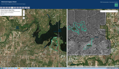
Historical Imagery Viewer
 The Historical Imagery Viewer enables educators to use technology to teach about change over time. Use the swipe tool back and forth across the imagery to compare the landscape then and now. Click the + button to zoom in for a closer look and the - button for an overview of the area.
The tool has many applications:
- Interpretation of land and erosional features on topographic maps.
- Interpretation of Earth surface features using a variety of methods such as satellite imagery, aerial photography, and topographic and geologic maps using appropriate technologies.
- Description of the physical characteristics of the United States and their impact on population distribution and settlement patterns in the past and present.
- Human development and land use patterns.