Fishing
- Licenses & Regulations
- ShareLunkers
- Fish Identification
- Fish Consumption
- Texas Freshwater Fisheries Center
Water Resources
- Texas Reservoir Levels
- US Army Corps of Engineers
- Texas Water Issues
- Golden Alga
- Aquatic Vegetation
5325
N. 3rd
Abilene, Texas 79603
(325) 692-0921
Michael Homer, Biologist
Local Information
- Breckenridge Chamber of Commerce
100 E Elm St
Breckenridge, Texas
(254) 559-2301
Nearby State Parks
Lake Daniel
Quick Links: Fishing Regulations | Angling Opportunities | Cover & Structure | Tips & Tactics
Lake Characteristics
Location: On Gonzales Creek in Stephens
County, 65 miles northeast of Abilene and about 10 miles south
of Breckenridge
Surface area: 950 acres
Maximum depth: 42 feet
Impounded: 1948
Water Conditions
Conservation Pool Elevation: 1,278 ft. msl
Fluctuation: Moderate, sometimes
prone to long periods of dropping water levels
Normal Clarity: Stained
Reservoir Controlling Authority
City of Breckenridge
209 N. Breckenridge Avenue
Breckenridge, Texas 76424
(254) 559-8287
Aquatic Vegetation
Floating-leaf pondweed when lake is full
Predominant Fish Species
Lake Records
Stocking History
Latest Survey Report
Lake Maps
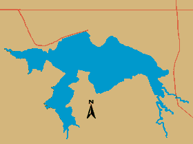
No contour map is available for this reservoir.
Fishing Regulations
All fishes are managed under statewide regulations. Anglers are reminded to consult the current fishing regulation booklet to verify these regulations are still in effect.
Angling Opportunities
| Species | Poor | Fair | Good | Excellent |
|---|---|---|---|---|
| Largemouth Bass | ||||
| Catfish | ||||
| Crappie | ||||
| Sunfish |
Fishing Cover/Structure
Lake Daniel offers a variety of fishing cover including black willow trees, button brush, lily pads, floating-leaf pondweed, and rocky structure. Cover in the reservoir is primarily limited to brush piles and rocks when the water is low.