History
Roots in the River
The Blanco River attracted Native Americans, the Spanish, and early settlers to its waters. Springs in the park provided water even when the river was dry. In 1721, the Spanish named the river “Blanco” for its white limestone banks.
Settlers arrived in the area in the 1800s. They established ranches, grazed cattle and built homes near the Blanco River.
Ranchers donated or sold their land to create Blanco State Park in 1933. With 104.6 acres, it is one of the smallest state parks in Texas.
A Park is Born
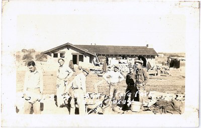
 Blanco State Park was one of the first four parks in Texas to receive a Civilian Conservation Corps (CCC) company. Franklin Delano Roosevelt created the CCC to help unemployed young men get back to work during the Great Depression.
Like some other CCC parks, Blanco was convenient for motorists traveling across Texas. Tourists could pull off the road to relax, swim, picnic, or camp.
Company 854 arrived here on June 16, 1933, and worked for 11 months building bridges, dams, structures, picnic areas, and roads. The CCC transformed the landscape and created a park where Texans could swim, fish, and camp.
You can still see their work today. Have a picnic on a stone bench or stone picnic table. Take a hike out to see the remnants of the pump house. Swim in one of the pools created by the CCC dams.
For more information:
- The Look of Nature: Blanco State Park
- A New Deal for Texas State Parks (e-book resource for teachers and students)
Rising River
The Hill Country received record amounts of rainfall in May of 2015. On May 23, 10-13 inches of rain fell at the headwaters of the Blanco River. The soil was already saturated and unable to absorb the rainfall. Most of the rain ran straight into the river.
The river swelled and rose an astounding 30 feet. Water rushed through the park, rising over the Kendalia and Texas 163 Loop bridges and touching the bottom of the U.S. Highway 281 bridge. The river continued on this path, devastating the park and land downstream.
Rebuilding Our Banks
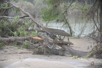
 Flood waters receded and left behind substantial damage. Uprooted trees, branches, sand, silt and trash littered the park. The high waters lodged uprooted trees 20 feet high in the surviving trees.
Park rangers and volunteers worked through the summer of 2015 repairing buildings, removing debris, and preparing the south side of the park to open on Aug. 1. After restoring the rest of the day use areas the whole park reopened on Oct. 24.
You will see signs of the flood today as you walk through the park. Our trees still lean in the direction of the flood water and debris piles are scattered throughout our trails and native areas.
For more information:
- National Weather Service: Memorial Weekend Flooding – May 2015
- Handbook of Texas Online: Blanco River

- Photo courtesy of Susan Downey
