The Guide to
Austin-area Birding Sites
Good places to see birds in and around Austin
North Area

19. Walnut
Creek Metropolitan Park*
(Bob Havens Ballfields);
Jourdan-Backman Pioneer
Farm; Northeast District
Park* - Walnut
Creek Metropolitan Park:
12138 North Lamar Blvd.
Jourdan-Bachman Pioneer
Farm: 11418 Sprinkle Cut-off
Rd., Austin TX 78754,
(512) 837-1215 Northeast
District Park: 5909 Coolbrook
Dr.
Location: This complex
(including the not-very-accessible
Walnut Creek Greenbelt
and Preserve) extends
discontinuously along
Walnut Creek for over
13 miles, from the MoPac
Expressway in the north
to the Colorado River
in the south. To reach
the Walnut
Creek Metropolitan Park from IH-35, take
Exit 244 (Yager Ln.) and
go west on Yager Ln..
At the intersection with
Lamar Blvd., turn left
(south) and follow Lamar
for 1/6 mile; the Park
entrance will be on the
right. To reach the Jourdan-Bachman
Pioneer Farm from IH-35:
Take Exit 245 (Parmer
Ln./FM 974). Go east on
Parmer Ln. for 2.3 miles
to the intersection with
Dessau Rd. Turn right
(south) onto Dessau Rd.
and follow it for 0.9
mile to the intersection
with Sprinkle Cut-off
Rd. Turn left (east) onto
Sprinkle Cut-off and follow
it for 0.5 mile to the
parking lot for the Pioneer
Farm, on the left. To
reach the Northeast
District Park from U.S. Highway
183, exit at Loyola Ln.
heading east. After 0.4
mile, turn left (north)
onto Crystalbrook Dr.;
the Park will be on the
right.
Habitats: Parkland. Riparian
woodland. Often good for
landbirds during migration.
Typical resident species
include Red-bellied
Woodpecker,
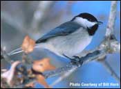
Carolina
Chickadee, Carolina Wren;
White-eyed Vireos are common during nesting
season. Scissor-tailed
Flycatchers are conspicuous
summer residents in the
fields of the Jourdan-Bachman
Pioneer Farm, a recreated
19th-century homestead.
See also Site
18.
Facilities: At Walnut
Creek Metropolitan Park:
trails, restrooms, water
fountains, picnic tables.
At Jourdan-Bachman: living
museum, trails, restrooms,
water stations, picnic
tables; entrance fee;
limited hours – call
in advance. At Northeast
District Park: restrooms,
water fountains, picnic
tables. A trail system
is planned for much of
the length of Walnut Creek.

20. Lake
Georgetown -
500 Cedar Breaks Rd.,
Georgetown TX 78628 (512)
930-LAKE (930-5253)
Location: Driving north
on IH-35 to Georgetown,
take Exit 261A (if you
are driving south on IH-35,
take Exit 261). Go west
on RM 2338 for 3.3 miles
to Cedar Breaks Rd. Turn
left (south) onto Cedar
Breaks Rd. and follow
it to the lake. Both the
north and south shores
of the lake have parks
(Jim Hogg, Russell, and
the primitive Walnut Spring
parks on the north shore;
Cedar Breaks Park and
the primitive Cedar Hollow
and Sawyer parks on the
south shore).
Habitats: Lake; oak-juniper
Hill Country environment.
The 16.6-mile Good Water
Trail partly circles the
lake; some stretches of
the Trail run through
Golden-cheeked
Warbler habitat (the most accessible
of these stretches are
in Cedar Breaks and Russell
parks). Lake Georgetown
itself usually isn’t
very birdy; but waterbirds
occasionally stop by,
especially during migration.
Facilities: Trails, restrooms,
water fountains, picnic
tables (all free). Fee
activities: boating and
camping. A map and descriptive
literature are available
by mail or during office
hours (8 a.m. to 4:30
p.m., Monday through Friday)
from the Lake Georgetown
Office on Cedar Breaks
Rd.
Further
exploration: Tejas
Camp (actually one of
the Lake Georgetown parks,
though located to the
west on the San Gabriel
River) can be good for
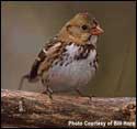
wintering sparrows, including
Harris’s
Sparrow.
From the Cedar Breaks
Rd./RM 2338 intersection,
turn left (north) onto
RM 2338 and follow it
for 3.3 miles to FM 3405.
Turn left (west) and follow
FM 3405 for 5.8 miles
to CR 258. Turn left (south)
and follow CR 258 for
1.5 mile. The entrance
to Tejas Camp will be
on the left.
The Granger
Lake area is
worth a visit, especially
during winter and migration.
The Lake is surrounded by
a number of parks and wildlife
management areas, and it is
worthwhile preparing for your
visit by requesting the free
map that is published by the
Granger Project Office (512/859-2668;
3100 Granger Dam Rd., Granger
TX 76530). From IH-35, take
Exit 261 in Georgetown. Follow
Texas Highway 29 east for
15.9 miles to the intersection
with Texas Highway 95. Turn
right (south) onto Texas 95
and follow it for 0.8 mile
to FM 1331. Turn left (east)
onto FM 1331 and follow it
to the two parks on the south
side of Granger Lake – Taylor
Park (on the
left at 4.7 miles) and Wilson
H. Fox Park (at 6.3 miles).
To avoid entrance fees, tell
the park attendants you are
just watching birds. Though
Granger Lake itself isn’t
often outstandingly birdy,
it is worth a scan (especially
during migration when large
flocks of American
White Pelicans and Franklin’s
Gulls are sometimes
present – late
October is a good time for
the latter). Birding by land
in the parks, especially Taylor
Park, is usually more rewarding.
From Fox Park, continue north
across Granger Dam. At the
north end of the dam, the
Project Office will be on
the right; literature and
a bird checklist are available
during business hours. The
Pecan
Grove Wildlife Area below
the dam’s spillway
is worth visiting during migration
and winter.
From the dam area, turn left
(west) onto FM 971 and follow
it 7 miles to the intersection
with CR 348; turn left (south)
onto CR 348 and follow it
2 miles to the intersection
with CR 346. Turn right (west)
onto CR 346 and follow it
0.8 mile to the intersection
with CR 347. This intersection
is the starting point for
a loop through the habitat
of wintering Mountain
Plovers and longspurs.
Turn left (south) onto CR
347 and follow it for 3.3
miles to the intersection
with CR 345. Turn right (north)
onto CR 345 and follow it
to the intersection with CR
346. Turn right (east) onto
CR 346 and follow it back
to the intersection with CR
347. Carefully scan plowed
fields on both sides of these
roads (as well as similar
fields in the general vicinity – for
example, the area north of
FM 971, especially around
CR 352 and 353). Only distant
views of Mountain
Plovers and longspurs
are usually granted, so a
spotting scope is essential.
From the CR 346/CR 347 intersection,
continue straight ahead on
CR 346 for 0.8 mile to the
intersection with CR 348.
Turn right onto CR 348 and
follow it to Willis
Creek Park,
a good spot for landbirds
during migration and winter.
Elsewhere around the Lake,
several parking areas allow
walking access to the wildlife
management areas (use
caution during hunting season – consult
with the Project Office on
restricted areas). Large grasslands
in the wildlife management
areas host wintering Northern
Harriers. In crop
areas during spring and summer,
watch fence and other lines
for such nesters as Dickcissel and Lark
Sparrow.
Austin-area Birding Sites
Texas Parks and Wildlife Department
4200 Smith School Road
Austin, TX 78744
or send a message to: nature@tpwd.texas.gov