The Guide to
Austin-area Birding Sites
Good places to see birds in and around Austin
Northwest Areas
22. Northwest
Park* - 700
Ardath Street (512)
453-0194
Location: From
Loop 1 (MoPac), take
the Anderson Ln. exit
heading east. At Anderson
Ln.’s intersection
with Shoal Creek Blvd.,
turn right onto Shoal
Creek and follow it
to the park.
Facilities: Restrooms,
water fountains, picnic
area, swimming. Supports
some habitat for birds.
Might be best during
spring and fall migrations
when migrants could
make landfall.

23. The
Balcones Canyonlands National
Wildlife Refuge -
Hartland Bank Building,
Suite 201, 10711 Burnet
Rd., Austin TX 78758 (512)
339-9432, extension 42
Location: From the U.S.
Highway 183/RM 1431 intersection
in Cedar Park, go north
on U.S. 183 for 9.7 miles
to the intersection with
Texas Highway 29 in Seward
Junction. Turn left (west)
onto Texas 29 and follow
it 2.3 miles to the RM
1869 intersection in Liberty
Hill. Turn left (west)
onto RM 1869 and follow
it for 8.9 miles. The
Shin
Oak Observation Deck will be on the left.
Habitat: Oak shinnery.
A shinnery is a thicket
of stunted oaks – “shin
oaks.” In this area,
Scalybark Oak is the dominant
shin oak species. As many
as five Black-capped
Vireo territories surround the
observation deck during
breeding season. Other
commonly-encountered nesters
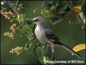
include Northern
Mockingbird, White-eyed
Vireo, Rufous-crowned
Sparrow, Yellow-breasted
Chat, and Painted
Bunting;
Northern
Bobwhite are
often heard (though seldom
seen), especially during
May and June. The shinnery
is also good in winter,
when flocks of sparrows
as well as Spotted
Towhees and other wintering birds
abound. A few feral Emus occur throughout the year.
Note: Black-capped
Vireos sing from late March to
mid-August. You have to
know the song to have
a good chance of locating
the bird. Do not attempt
to lure vireos by using
recordings – that
is illegal harassment
of this endangered species
and this will not be tolerated.
For familiarization, listen
to song tapes beforehand
or stop in the interpretive
area near the observation
deck to play the low-volume
song tape at the sound
post. Black-capped
Vireos are far more often heard
than seen, and sightings
rarely last more than
a few seconds – usually
less. Be patient. Stay
in marked areas: poison
ivy, ticks, rattlesnakes,
and other such creatures
(plus sinkholes) abound
in the shinnery.

Facilities: Observation deck, bird sightings log, interpretive signs, sound post (often broken), Refuge brochure. Wheelchair accessible. A Refuge bird checklist is being developed. Further exploration: The Refuge is also developing a trail system on the Doeskin Ranch (Nagel Tract), with opening projected for the year 2000; call for the latest information. From the entrance to the Shin Oak Observation Deck, continue west on RM 1869 for 1.4 mile to the intersection with RM 1174. Turn left (south) onto RM 1174 and follow it for 2.5 miles. The entrance to the Doeskin Ranch will be on the left. The trails (one of them wheelchair accessible) will run through creekside areas along Doeskin Branch and also through native grassland, as well as to the top of Post Oak Ridge – the latter a steep trek of about 3/4 mile (one way). This is typical Balcones Canyonlands habitat; common resident birds include “Black-crested” Titmice, Bewick’s Wrens, Northern Cardinals, Rufous-crowned and Field sparrows. A few Golden-cheeked Warblers nest along the edge of Post Oak Ridge; Black-and-white Warblers nest in the same habitat. There is a hawk watch at Doeskin Ranch during National Wildlife Refuge Week in October; good numbers of southbound Turkey Vultures are usually recorded, along with a scattering of other species. From September through mid-October, stands of Frostweed often provide excellent butterfly habitat (especially for migrating Monarchs). See also Site 24.

24. Cow
Creek Rd. -
Lago Vista Area Chamber
of Commerce: P.O. Box
4946, Lago Vista TX 78645
(512) 267-7952 or toll-free
(888) 328-5246
Location: Go north on U.S.
Highway 183 to the RM 1431
intersection in Cedar Park.
Turn left (west) onto RM
1431; follow it for 17.8
miles to the intersection
(on the right) with Cow
Creek Rd. Cow Creek Rd.
is 8.6 mostly unpaved miles
in length, much of it running
along Cow Creek.
Habitats: Areas along the
creek are heavily used by
both migrants and summer
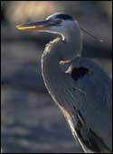
and winter residents. Great
Blue Heron, Wild Turkey,
Greater Roadrunner, Belted
Kingfisher, Eastern Phoebe,
Canyon Wren, and Lesser
Goldfinch are present year-round.
Summer residents include
Painted
Bunting, Blue Grosbeak, and Summer
Tanager. American Robins,
Cedar Waxwings,
a number of sparrow species,
and American
Goldfinches are often abundant in winter.
Unusual wintering raptors
found along the road have
included Zone-tailed
Hawk and Merlin. Many stretches
of the road run through
cedar breaks (stands of
Ashe Juniper); this habitat
is relatively ‘bird-free’,
though resident Western
Scrub-Jays are fairly common.
Eastern
Bluebirds occur
year-round where the roadside
borders fields. In years
with adequate rainfall,
the roadsides have outstanding
spring and early summer
wildflower displays.
Facilities: At present,
none along Cow Creek Rd.
itself. Hiking and biking
trails are under development
in the Lago Vista area and
may eventually extend to
the road; a bird checklist
for the area and a spring
birding festival are in
the works. Contact the Lago
Vista Area Chamber of Commerce
for current information.
Gasoline, food, and other
requirements are available
in Lago Vista, about 7 miles
east of Cow Creek Rd. on
RM 1431; food is available
at Cow Creek Lodge (1.2
mile east).
Further
exploration: Cow
Creek Rd. ends at RM 1174.
Turning right (north) onto
RM 1174 will bring you,
after 1.3 mile, to the Doeskin
Ranch tract of the Balcones
Canyonlands
National Wildlife Refuge (see Site
23). In
some years, Cassin’s
Sparrows nest along RM 1174.
The Lower Colorado River
Authority’s Primitive
Recreation Areas at Gloster
Bend and Turkey
Bend are
worth investigating, especially
during winter and the spring
migration. Both front on
Lake Travis. Gloster Bend
is accessed via Singleton
Rd., approximately 6 miles
west of Lago Vista off RM
1431. Turkey Bend is accessed
via Shaw Dr., approximately
9.5 miles west of Lago Vista
off RM 1431. Both areas
have entrance fees. For
more information, call (512)
473-4083.
Serendipity, a residence
on heavily wooded acreage
east of Lago Vista, is
open by reservation (512/259-0299).
Guided tours focus on
native plants and wildlife.
Hummingbirds abound, especially
during migation (mostly
Black-chinned and Ruby-throated
hummingbirds, with the
occasional Rufous
Hummingbird in fall and winter; Green
Violet-Ear has been recorded
once).
Notes: Use caution
in parking along Cow Creek
Rd.. Watch for flooding
at low-water crossings
and also for loose cattle.
Be sure not to trespass
(virtually no public land
fronts on the Rd., and
basically all of the creekbed
is private property).
This road is definitely
worth a site-seeing drive
even if there is no place
to hike.

25. Travis
Audubon Society's "Baker
Woods" Wildlife Sanctuary -
12219 Lime Creek Rd., Leander
TX 78641 (512) 219-8425
Location: See notes below.
Go north on U.S. Highway
183 to the intersection
with RM 1431 in Cedar Park;
turn left (west) onto RM
1431. After 1.8 mile, turn
left (south) onto Lime Creek
Rd. Follow Lime Creek Rd.
for 2.4 miles; the Sanctuary
parking lot will be on the
left.
Habitats: Oak-juniper woodland
and riparian areas. Excellent
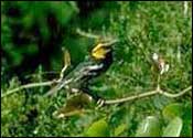
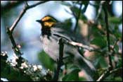
for Golden-cheeked
Warblers from mid-March to mid-June:
about 50 pairs nest on the
Sanctuary’s 680 acres.
Facilities: Three trail
systems, two on the Sanctuary’s
south side and one north
of Lime Creek Rd.; initial
stretches of the Hatfield
(Orange) and North (Green)
trails are wheelchair accessible.
Information kiosk. Bird
sightings log (part of the
visitors’ registration
book). A trail guide booklet
is in preparation. Open
house with guided tours
in late March. No entrance
fee; donations accepted.
Notes: The Sanctuary is
closed part of the year;
to
avoid disappointment, call
in advance. Be sure
to sign the visitors’ registration
book, located near the entrance
to the parking lot; for
safety reasons, indicate
the trail you plan to take.
Some stretches of trail
are steep and rocky; wear
appropriate footgear. The
Hatfield Trail is the easiest
and shortest of the three
trails (at 2 miles round
trip); the North Trail the
longest and most difficult;
the Baker Springs (Blue)
Trail is the most heavily
traveled. Please
observe all posted rules. The address
shown above is expected
to change sometime after
1999.

26. St.
Edward's District Park*
(Upper Bull Creek District
Park); Forest Ridge Preserve*;
Bull Creek Greenbelt*;
Bull Creek District Park* -
Bull Creek District Park:
6700 Lakewood Dr.
Location: This complex extends
discontinuously along Bull
Creek for about 6 miles.
Not all areas on the Greenbelt
are readily accessible.
The parking lot for St.
Edward's District Park lies
on the west side of westbound
Spicewood Springs Rd., 2.3
miles north of its intersection
with Loop 360 (Capital of
Texas Highway). Forest
Ridge Preserve: Call the Preserve
Office (480-3060) for directions.
Bull
Creek Greenbelt: From
the Loop 360/eastbound Spicewood
Springs Rd. junction, go
east 0.1 mile on eastbound
Spicewood Springs, then
turn right (south) onto
Old Spicewood Springs Rd.;
follow it 0.1 mile to the
parking lot, on the right.
Bull Creek District Park:
From the Loop 360/RM 2222
junction, go east 0.1 mile
on RM 2222. Turn left (north)
onto Lakewood Dr. and follow
it 0.5 mile to the Park.
Habitats: Riparian woodlands
along Bull Creek. Oak-juniper
woodlands. Open fields.
Golden-cheeked
Warblers nest in the Forest Ridge
Preserve; special permission
is required before entering
the Preserve during nesting
season.
Facilities: Trails. Restrooms,
water fountains, and picnic
tables in Bull Creek District
Park.
27. Emma
Long Metropolitan Park*
(City Park) -
1600 City Park Rd. (512)
346-1831
Location: From the Loop
360 (Capital of Texas Highway)/RM
2222 (Bull Creek Rd.) junction,
go west on RM 2222 for 0.5
mile to the intersection
with City Park Rd. Turn
left (south) onto City Park
Rd. and follow it to the
Park.
Habitats: Oak-juniper woodland.
Lakefront and open lake.
Turkey
Creek Trail, about
a mile in length, is a good
area for Golden-cheeked
Warblers from mid-March
to mid-June. The trailhead
is on the right (north)
side of City Park Rd., 4.8
miles west of its intersection
with RM 2222 (and 1.5 mile
east of the Park’s
fee-collection booth); there
is a parking area 0.1 mile
west of the trailhead. The
lakefront area is often
crowded and seldom particularly
birdy, though waterbirds
may sometimes be present
(especially in winter).
Facilities: Trail; picnic
area. There is an entrance
fee for the main portion
of the Park (though not
for Turkey Creek Trail):
the fee-required portion
of the Park offers restrooms,
water fountains, swimming,
and camping.
Austin-area Birding Sites
Texas Parks and Wildlife Department
4200 Smith School Road
Austin, TX 78744
or send a message to: nature@tpwd.texas.gov