History
Humans have had a connection to this land for millennia. They were drawn here by the abundant resources.
Early residents
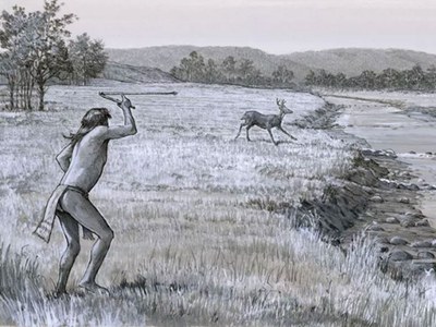
Early peoples subsisted on the bounty of the prairies, savannahs and bottomland hardwoods. They were hunters and gatherers such as the Paleoindians (10000 – 6000 B.C.) and Archaic peoples (6000 – 200 B.C.).
While here, they hunted and butchered the meat, made and repaired tools, and gathered wild plants such as berries and roots. They used the area as a campsite for a short time before moving on, following the animal herds.
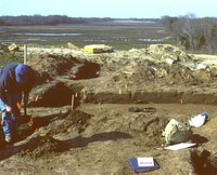
A group called the Woodland peoples lived here from 200 B.C. – 800 A.D. The Woodland peoples considered this a part of their home territory. Archeologists located a Woodland peoples camp and a small cemetery near the Cooper Lake dam.
Later still, the Caddo (800 A.D. – 1800 A.D.) lived in the area. The Caddo came here to hunt and gather edible plants. They did not raise crops or build settlements.
While here, the Caddo improved their large trading network with items like bison hides, salt, bois d’arc wood for bows, and ornate pottery.
The Cherokee moved into the area in the early 1800s. European settlers and farmers who moved into the area in the mid-1800s feared conflict with the Cherokee.
Homesteading
The Republic of Texas deployed troops under Gen. Kelsey H. Douglass to remove the Cherokee and their allies from this area, culminating in the Cherokee War of 1839. This cleared the way for more European settlers to move into what is now Hopkins County.
Homesteaders were self-sufficient, growing vegetable gardens and raising cotton, hay, dairy cattle, hogs, chickens, horses and mules. They hunted and gathered what the land provided, as early peoples did before them. Cotton and dairy became the main industries.
Be sure to visit the Southwest Dairy Museum in Sulphur Springs to learn more about the history of dairy farming in Hopkins County.
Building a lake . . .
Area residents, led by local landowners Grover Pickering and Quentin Miller, first proposed the construction of a reservoir for flood control and water storage in the late 1930s. (3)
In 1948, Congressman Wright Patman requested a feasibility study for a dam and reservoir on the South Sulphur River. The U.S. Army Corps of Engineers published a favorable report in 1950.
In the early 1950s, the cities of Sulphur Springs and Commerce, along with Delta County, signed on with the project. The Cooper Dam bill was passed and signed in 1955.
The reservoir project hit the first of a series of stumbling blocks in 1957, when the Corps announced that the damsite would need to move six miles downstream. Setbacks delayed dam construction for the next 30 years.
Construction of an earthen fill dam and spillway finally began in 1986. The formal dedication of the Cooper Dam occurred in 1991. The lake filled in the fall of 1991 and flooded bottomland hardwood forests and upland prairies and oak savannahs.
The U.S. Army Corps of Engineers owns Jim Chapman Lake and surrounding properties in Delta and Hopkins counties. Parks and a wildlife management area surround the 19,300-acre lake.
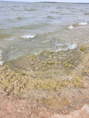
 Traces of earlier homes lie under the waters of Jim Chapman Lake, as shown by these bricks from the Albert Dawson homestead at Pelican Point Day-use Area.
Please leave artifacts where you find them – don’t pocket the past!
. . . and a park
The State of Texas leased property for the Cooper State Park Complex from the U.S. Army Corps of Engineers in January 1991. The park consists of two units.
Doctors Creek Unit has 466 acres in Delta County. It opened for boat access in November 1992 and opened fully on Jan. 3, 1996. The South Sulphur Unit, with 2,560 acres in Hopkins County, opened April 27, 1996.
What’s in a name?
Cooper Lake, named for the nearby town of Cooper, changed names in 1998 with an act of Congress. Cooper Lake became Jim Chapman Lake in honor of the former Congressman from nearby Sulphur Springs. However, the lake is still known locally as Cooper Lake.
Two stories explain Doctors Creek and the park unit’s names. One story says that Native Americans gathered herbs on the creek bank and brewed them in the dry creek bed to heal their sick. The other recounts that a doctor bogged down his horse and buggy while crossing the creek.
Switch cane made excellent buggy whips and was often needed to encourage horses to make deep stream crossings. This cane gave its name to Buggy Whip Creek and later to the Buggy Whip Equestrian Camping Loop.
The South Sulphur River is the origin for South Sulphur Unit’s name.


