Preparing for a River Trip
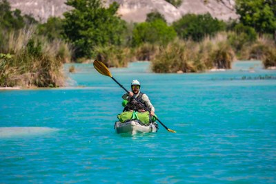
Despite the beautiful setting, a trip down the Devils River can be challenging to plan, exhausting to navigate, and life-threatening to the unprepared. Only experienced paddlers should embark on a Devils River trip.
Planning Required!
- Bring all supplies with you, as no stores are nearby.
- Cell phone service is limited on the drive here and unavailable near and on the river.
- Have a plan and know your access points!
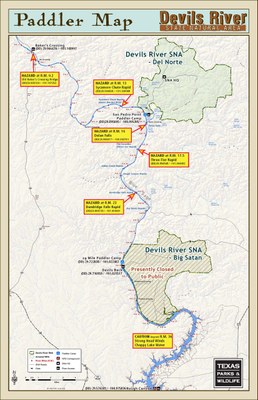
Public access points (north to south)
- RM 0 Bakers Crossing
- RM 12 Paddler Camp - by reservation and DRAP permit ONLY
- RM 15 San Pedro Point at DRSNA Del Norte Unit - by reservation and DRAP permit ONLY
- RM 20 Paddler Camp - by reservation and DRAP permit ONLY
- RM 29 Paddler Camp - by reservation and DRAP permit ONLY
- Rm 30 Devils Back Campground at DRSNA Dan A. Hughes Unit - by reservation and DRAP permit ONLY
- RM 33 Paffords Crossing Day-use Area at DRSNA Dan A. Hughes Unit - by reservation and DRAP permit ONLY
- RM 47 Rough Canyon Marina at Lake Amistad Recreational Area
Shuttles & parking
Self-shuttling for a river trip may seem convenient. However, road conditions, mileage, time commitment and vehicle staging limits make it a challenge.
Rough gravel roads lead to and through the SNAs. Seasonal rains can damage the roads. Conservative drive times between drop-off and take-out points are:
- DAH unit to Bakers Crossing: two hours
- Del Norte unit to Bakers Crossing: 2.5 hours
- Del Norte to DAH unit: two hours river to river
- DAH to Rough Canyon Marina: one hour
- Rough Canyon to Del Norte: 1.75 hours
Note: You may not leave vehicles at either unit when they are closed. You must remove your vehicle by 5 p.m. on Monday or we will have it towed at your expense. Paddlers must pay a $5 per day, per vehicle fee.
Want to simplify the trip and avoid the headache? Find a TPWD-approved outfitter or shuttle service.
Camping
Paddlers with DRAP permits can stay at one of our paddler camps, but you must reserve and pay for campsites in advance.
Paddler camps are open seven days a week. Only one-night stays are allowed.
You’ll also need a DRAP permit to head south and camp on the Lake Amistad section of the lower Devils River. Contact Amistad National Recreation Area at (830) 775-8779 or visit NPS Campground: Rough Canyon.
Camping on islands within the river, while legal, can be extremely dangerous if the river rises. The islands may be crowded.
Camping or hiking along the riverbank above the gradient boundary is trespassing, unless you have permission from the landowner.
Private property
Most of the land along the Devils River is private. Although you may believe you are miles away from the nearest home or another human, you are not.
Over the years, landowners have had to deal with trespassing and other illegal activities such as fires, firewood gathering, and littering. They watch their properties carefully and will file trespassing charges.
Paddler Information and Map
 Read and print a paddler map, which has critical information that every paddler must know before taking a trip on the Devils River.
Thinking about paddling the full distance? Baker's Crossing to Lake Amistad is 47.7 river miles and takes at least four full days (longer if river flow is under 75 cfs).
Preparing for Your Trip
You must have a Devils River Access Permit (DRAP) if you plan to access the Devils River State Natural Area units or paddler camps. A DRAP costs $10. Camping and other park fees may also apply.
- Read an overview of the Devils River Access Permit.
- Call (512) 389-8901 to obtain a DRAP and reserve campsites.
- Review available guides of the Devils River and surrounding area.
Other things to remember:
- Sanitation: Pack out what you bring in. Cat holes are not acceptable on the Devils River. WAG bags are required for human waste. Purchase them online or in most sporting goods sections.
- Trash: You must remove all trash.
- Cooking: We recommend containerized fuel camp stoves for cooking while paddle camping.
- Campfires: Campfires are not allowed along the Devils River State Natural Area waterfront or at any of the TPWD-sanctioned paddler camps. Val Verde County remains in a burn ban most of the year.
Pro tips:
- Secure all loose items (including coolers) in your boat to withstand swamping and rollovers.
- Pack as lightly as possible.
- Use dry bags for trash. This helps avoid rips that could pollute the river and keeps trash out of reach of critters!
Everyone plays a role in keeping the river clean. Be a responsible paddler and leave it better than you found it!
Weather
 Know the conditions before you go. The Devils River can flash flood and become dangerous very quickly. Check the latest weather forecast and water levels before going on your trip.
The best times to go are spring and fall. Begin each day early to take advantage of daylight!
Low water levels may cause canoes and kayaks to drag, requiring repairs while on the water. Don’t forget a repair kit specific to your watercraft!
Other notes:
- You may need to portage around shallow waters.
- The prevailing headwinds can make for an exhausting trip.
- Extremely high or low temperatures can occur unexpectedly.
Getting There
Put-in access
Baker's Crossing
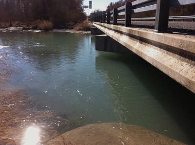
 Baker's Crossing is 62 miles south of Ozona on State Highway 163, or 70 miles southwest of Sonora. Coming from Del Rio, Baker's Crossing is 21 miles north of Comstock on State Highway 163. (DD) 29.96628755 / -101.1491288
Distance to Baker's Crossing:
- Sonora: 70 miles
- Ozona: 62 miles
- Comstock: 21 miles
- Del Rio: 55 miles
- San Antonio: 200 miles
- Austin: 280 miles
- Houston: 397 miles
- Dallas: 400 miles
Del Norte Unit
Find directions on our Maps page.
- Permits and reservations: (512) 389-8901
- Park information: (737) 289-3250
This unit is open from 8 a.m. to 5 p.m. Friday to Monday. The paddler parking area is .9 miles from the river and requires a day pass permit. All vehicles must be removed before 5 p.m. on Monday. Make prior arrangements with an outfitter if you can’t carry your gear that far or have time constraints.
Take-out access
Dan A. Hughes Unit
Two take-outs are available at this unit: The RM 30 Devils Back Campground and the Paffords Crossing Day-use Area. Day pass reservations are required. Find directions on our Maps page.
Rough Canyon Marina
Public take-out at Rough Canyon Marina at Lake Amistad National Recreation Area is on the left (east) side of the lake. Be prepared for headwinds. Phone: (830) 775-8779 (DD) 29.57717 / -100.97788
River Description
The river offers a mix of slow-moving pools and brief Class I to Class II rapids. Several other rapids could be considered Class III when water levels are high.
Hazardous conditions may exist anywhere along the river. The movement of water has created an uneven limestone riverbed. This, combined with submerged boulders, often leads to leg injuries. This same limestone is very abrasive and will quickly wear a hole in a boat.
Most major mishaps occur at the three rapids listed below, but expect to encounter other difficulties created by tight channels, shallow fast rapids, headwinds and river cane. Changing water levels will affect all river conditions.
Game Warden Rock
About 13.3 miles downstream from Baker's Crossing, look for a large rock in the middle of the main river right channel. (Game Warden Rock is also known as Sycamore Chute.)
Consider portage as boats are often damaged beyond repair here. Position your boat on the left side of the main chute to move through the four-foot drop. Beware of low-hanging trees on river right, below the rapid.
Loitering above this rapid on private property longer than the time it takes to actively scout and portage can lead to trespassing charges.
Dolan Falls
 We strongly recommend that you portage around Dolan Falls, a 10-foot Class IV waterfall about 16.4 miles downstream from Baker's Crossing. Injury and loss of equipment are common when paddlers attempt to run Dolan Falls.
Look for the large warning sign posted on a boulder on river left as you approach. Take out early above the falls, and portage on river left or right.
The riverbanks surrounding the falls are private property. Don’t loiter there more than the time it takes to actively scout and portage the falls, or you will be trespassing.
Three-Tier Waterfall
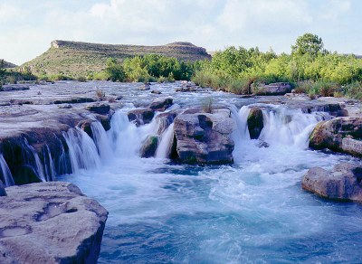
This Class II to III waterfall, also known as the Cascades, is about 20.4 miles below the put-in at Baker's Crossing. It requires careful negotiation. Scout prior to running if possible, and approach from river right.
Wildlife and Ecology
The spring-fed Devils River is one of the most pristine rivers in the state. It is well known for its exceptional water clarity. Learn more on our Nature page.
Paddlers have never reported any animal attacks, nor have they reported needing a firearm to defend themselves from an animal attack.
Shuttle and Guide Service
The following outfitters provide shuttle and guide services for paddling and fishing trips that launch and/or take out on the Devils River State Natural Area units.
- Amistad Expeditions: Shuttle service and boat rentals. (830) 703-0127
- Angell Expeditions: Guided kayak and canoe trips. (432) 384-2307
- Far West Texas Outfitters: Guided paddling and fishing trips. (432) 229-2054
- Imagine That Outfitters: Guided fishing trips. (210) 792-5234
Note: Accessing the Devils River SNA properties or campsites through un-approved services could result in fines and cancellation of all permits or reservations.
Additional Resources
Where to stay in the area:
- Devils River State Natural Area-Del Norte & Dan A Hughes Units
- Seminole Canyon State Park & Historic Site
- Del Rio lodging
River information:
- Fishing Regulations for Devils River
- Southwest Paddler website: Additional information about planning a trip, and potential river hazards
- Devils River Conservancy. - Visitor & Paddler Information
Related links:
