Commission Agenda Item No. 6
Presenter:
Ted Hollingsworth
Action
Acceptance of Land Transfer from Texas Department of Transportation – Palo Pinto County - Approximately 20 Acres at Palo Pinto Mountains State Park
August 25, 2016
I. Executive Summary: Texas Department of Transportation (TxDOT) is willing to transfer approximately 20 acres of land to Texas Parks and Wildlife Department (TPWD). This tract will serve as the right-of-way (ROW) for Park Road 77, which will provide access to the recently acquired Palo Pinto Mountains State Park (PPMSP).
II. Discussion: Acquisition of land for PPMSP began in late 2011. Since then several more tracts have been added and the park now consists of about 4,600 acres of rugged limestone hills and breaks, 90-acre Tucker Lake, and several miles of the north fork of Palo Pinto Creek, straddling Palo Pinto and Stephens Counties about 70 miles west of Fort Worth. Baseline cultural and natural resource inventories, and planning for park development and public use are well under way.
Access to the park is currently via FM 2372, which originates in Strawn, about 4 miles to the east of the current park entrance. The road separates the park from a single ranch owner for a distance of roughly 2 miles. TPWD staff has asked TxDOT to transfer this reach of ROW to TPWD. TPWD ownership of the ROW would allow alternations to the road to facilitate traffic flow and maximize the visitor experience. The adjacent landowner would retain an easement for uninterrupted access to the landowner’s ranch.
III. Recommendation: The staff recommends the Texas Parks and Wildlife Commission adopt the following motion:
“The Texas Parks and Wildlife Commission authorizes the Executive Director to take all necessary steps to accept the donation of approximately 20 acres of land adjacent to Palo Pinto Mountains State Park in Palo Pinto County.”
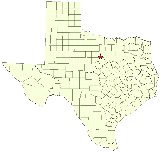
Commission Agenda Item No. 6
Exhibit A
Location Map for Palo Pinto Mountains State Park in Palo Pinto and Stephens Counties
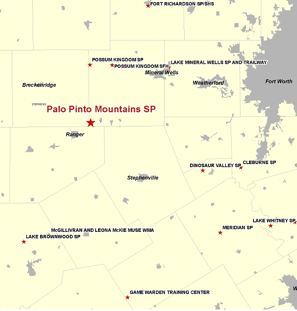
Commission Agenda Item No. 6
Exhibit B
Vicinity Map for Palo Pinto Mountains State Park – 70 Miles West of Fort Worth
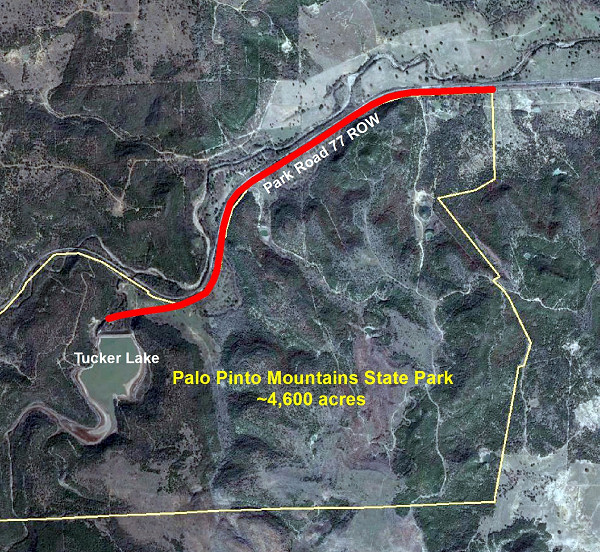
Commission Agenda Item No. 6
Exhibit C
Site Map for Subject 20-Acre Access Road Right-of-Way
Subject Tract Shown in Red